Discover Ontario's history as told through its plaques
2004 - Now in our 15th Year - 2019
To find out all about me, you can visit the Home Page
Looking at this page on a smartphone?
For best viewing, hold your phone
in Landscape mode (Horizontal)
The Bruce Mines
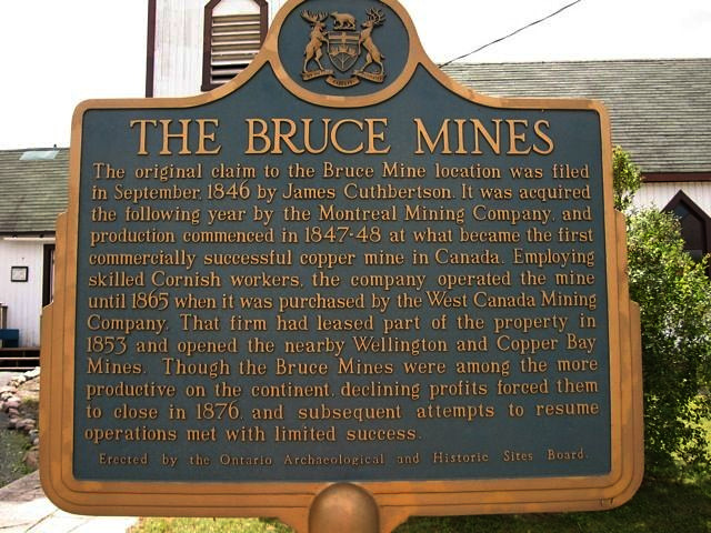
Photo by contributor Burke Lush - Posted August, 2006
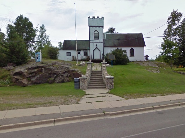
Photo from Google Street View ©2011 Google - Posted January, 2011
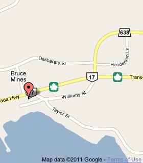
Plaque Location
The District of Algoma
The Town of Bruce Mines
On the grounds of the Bruce Mines Museum
on the south side of Highway 17
one long block west of Road 638
Coordinates: N 46 18.023 W 83 47.285 |
 |
Plaque Text
The original claim to the Bruce Mine location was filed in September, 1846 by James Cuthbertson. It was acquired the following year by the Montreal Mining Company, and production commenced in 1847-48 at what became the first commercially successful copper mine in Canada. Employing skilled Cornish workers, the company operated the mine until 1865 when it was purchased by the West Canada Mining Company. That firm had leased part of the property in 1853 and opened the nearby Wellington and Copper Bay Mines. Though the Bruce Mines were among the more productive on the continent, declining profits forced them to close in 1876, and subsequent attempts to resume operations met with limited success.
More
Information
More
Mining
Here are the visitors' comments for this page.
(none yet)
Here's where you can send me a comment for this page.
Note: Your email address will be posted at the end of your comment so others can respond to you unless you request otherwise.
Note: Comments are moderated. Yours will appear on this page within 24 hours (usually much sooner).
Note: As soon as I have posted your comment, a reply to your email will be sent informing you.
Thanks
Alan L Brown
Webmaster