Discover Ontario's history as told through its plaques
2004 - Now in our 13th Year - 2017
To see what's new on this site, you can visit the Home Page
Looking at this page on a smartphone?
For best viewing, hold your phone
in Landscape mode (Horizontal)
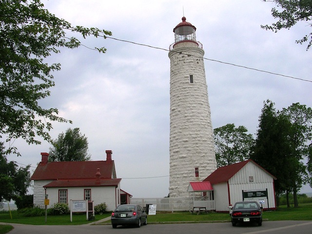
Point Clark Lighthouse
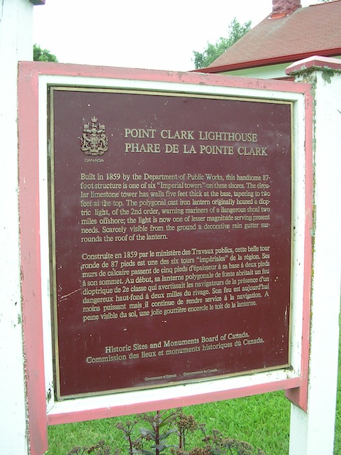
Photos by contributor Jocelyn Gordon - Posted July, 2010
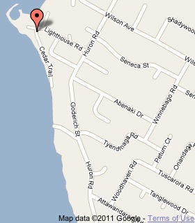
Plaque Location
The County of Bruce
The Township of Huron-Kinloss
At Point Clark Lighthouse National Historic Site
at the west end of Lighthouse Road off Huron Road
5 km west of Amberley
Coordinates: N 44 04.374 W 81 45.419 |
 |
Plaque Text
Built in 1859 by the Department of Public Works, this handsome 26 m structure is one of six "Imperial towers" on these shores. The circular limestone tower has walls 150 cm thick at the base, tapering to 61 cm at the top. The polygonal cast iron lantern originally housed a dioptric light, of the 2nd order, warning mariners of a dangerous shoal 3.2 km offshore; the light is now one of lesser magnitude serving present needs. Scarcely visible from the ground a decorative rain gutter surrounds the roof of the lantern.
Related Ontario plaques
Point Abino Lighthouse
Point Mississauga Lighthouse
Port Burwell Lighthouse 1840
Related Toronto plaques
Gibraltar Point Lighthouse
Queen's Wharf Lighthouse
More
Information
More
Boating
Here are the visitors' comments for this page.
(none yet)
Here's where you can sent me a comment for this page.
Note: Your email address will be posted at the end of your comment so others can respond to you unless you request otherwise.
Note: Comments are moderated. Yours will appear on this page within 24 hours (usually much sooner).
Note: As soon as I have posted your comment, a reply to your email will be sent informing you.
To send me your comment, click .
Thanks
Alan L Brown
Webmaster
Note: If you wish to send me a personal email, click .