Discover Ontario's history as told through its plaques
2004 - Now in our 15th Year - 2019
To find out all about me, you can visit the Home Page
Looking at this page on a smartphone?
For best viewing, hold your phone
in Landscape mode (Horizontal)
Bradlo
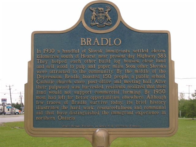
Photo by Alan L Brown - Posted June, 2006
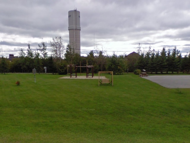
Photo from Google Street View ©2011 Google - Posted January, 2011
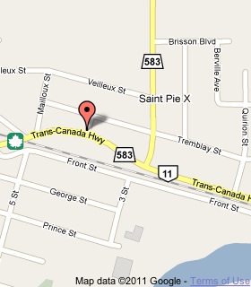
Plaque Location
The District of Cochrane
The Town of Hearst
In the playground area of the
Hearst Tourist Information Centre
on the south side of Highway 11 just west of Highway 583
Coordinates: N 49 41.347 W 83 39.118 |
 |
Plaque Text
In 1930 a handful of Slovak immigrants settled eleven kilometres south of Hearst near present-day Highway 583. They helped each other build log houses, clear land and sell wood to pulp and paper mills. Soon other Slovaks were attracted to the community. By the middle of the depression, Bradlo boasted 150 people, a public school, Catholic church, store, post-office and meeting hall. After their pulpwood was harvested, residents realized that their land would not support commercial farming. By 1950, most had left for better opportunities elsewhere. Although few traces of Bradlo survive today, its brief history illustrates the hard work, resourcefulness and communal aid that have distinguished the immigrant experience in northern Ontario.
More
Information
More
Settlements
More
Disasters
More
Hearst Plaques
Here are the visitors' comments for this page.
(none yet)
Here's where you can send me a comment for this page.
Note: Your email address will be posted at the end of your comment so others can respond to you unless you request otherwise.
Note: Comments are moderated. Yours will appear on this page within 24 hours (usually much sooner).
Note: As soon as I have posted your comment, a reply to your email will be sent informing you.
To send me your comment, click .
Thanks
Alan L Brown
Webmaster
Note: If you wish to send me a personal email, click .