Discover Ontario's history as told through its plaques
2004 - Now in our 12th Year - 2016
To see what's new on this site, you can visit the Home Page
Looking at this page on a smartphone?
For best viewing, hold your phone
in Landscape mode (Horizontal)
Fighting Island 1838
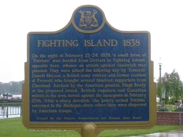
Photo by Alan L Brown - Posted September, 2004
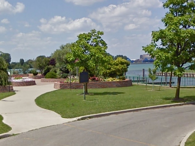
Photo from Google Street View ©2011 Google - Posted February, 2011
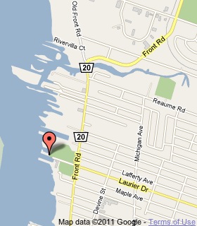
Plaque Location
The County of Essex
The Town of La Salle
In a park at the foot of Laurier Street near the water's edge
Coordinates: N 42 14.243 W 83 06.347 |
 |
Plaque Text
On the night of February 23-24, 1838, a small force of "Patriots" was ferried from Detroit to Fighting Island, opposite here, whence an attack against Sandwich was planned. They were joined the following day by "General" Donald McLeod, a British army veteran and former resident of Prescott who brought several hundred supporters from Cleveland. Advised by the American general, Hugh Brady, of the proposed attack, British regulars and Canadian militia in the area moved against the insurgents on February 25th. After a sharp skirmish, the poorly armed "Patriots" retreated to the Michigan shore where there were dispersed by American troops.
More
Information
Here are the visitors' comments for this page.
(none yet)
Here's where you can sent me a comment for this page.
Note: Your email address will be posted at the end of your comment so others can respond to you unless you request otherwise.
Note: Comments are moderated. Yours will appear on this page within 24 hours (usually much sooner).
Note: As soon as I have posted your comment, a reply to your email will be sent informing you.
To send me your comment, click .
Thanks
Alan L Brown
Webmaster
Note: If you wish to send me a personal email, click .