Discover Ontario's history as told through its plaques
2004 - Now in our 13th Year - 2017
To see what's new on this site, you can visit the Home Page
Looking at this page on a smartphone?
For best viewing, hold your phone
in Landscape mode (Horizontal)
Fort Frontenac
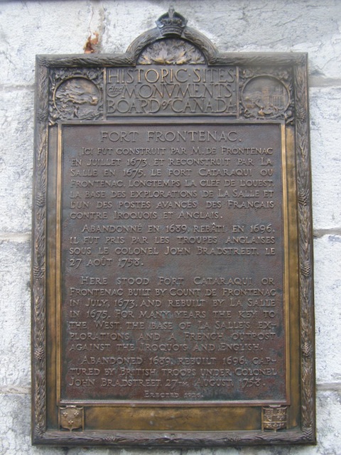
Photo by contributor Colin Old - Posted November, 2009
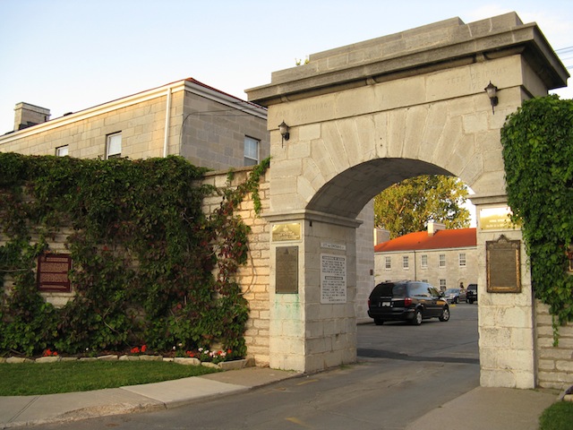
Photo by contributor Wayne Adam - Posted December, 2009
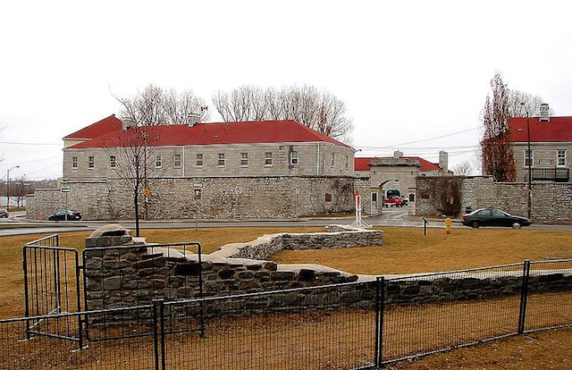
Photo Source - Wikimedia
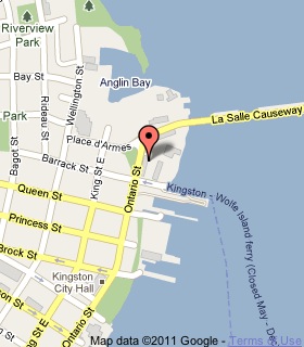
Plaque Location
The County of Frontenac
The City of Kingston
On the right side entrance gate at
Tete du Pont Barracks at 1 Ontario Street
east of Barrack Street
Coordinates: N 44 14.004 W 76 28.709 |
 |
Plaque Text
Here stood Fort Cataraqui or Frontenac built by Count de Frontenac in July, 1673, and rebuilt by La Salle in 1675. For many years the key to the West, the base of La Salle's explorations and a French outpost against the Iroquois and English. Abandoned 1689, rebuilt 1696, captured by British troops under Colonel John Bradstreet, 27th August, 1758.
Another plaque at this location
The Crawford Purchase
Related Ontario plaque
René-Robert Cavelier de La Salle at Cataracoui
More
Information
More
Military
More
Kingston Plaques
Here are the visitors' comments for this page.
(none yet)
Here's where you can sent me a comment for this page.
Note: Your email address will be posted at the end of your comment so others can respond to you unless you request otherwise.
Note: Comments are moderated. Yours will appear on this page within 24 hours (usually much sooner).
Note: As soon as I have posted your comment, a reply to your email will be sent informing you.
To send me your comment, click .
Thanks
Alan L Brown
Webmaster
Note: If you wish to send me a personal email, click .