Discover Ontario's history as told through its plaques
2004 - Now in our 14th Year - 2018
To see what's new on this site, you can visit the Home Page
Looking at this page on a smartphone?
For best viewing, hold your phone
in Landscape mode (Horizontal)
Fort Henry
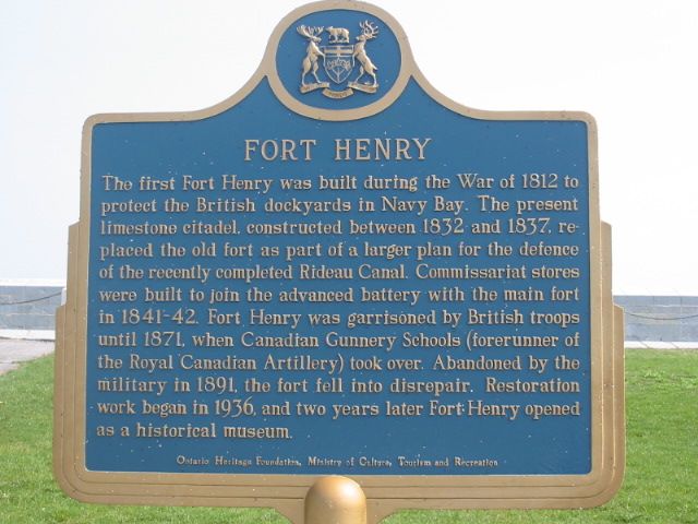
Photo by Alan L Brown - Posted June, 2004
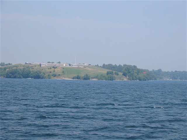
Photo by Alan L Brown - Posted July, 2007
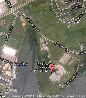
Plaque Location
The County of Frontenac
The City of Kingston
On the parade square just inside the pedestrian entrance gate
Coordinates: N 44 13.831 W 76 27.641 |
 |
Plaque Text
The first Fort Henry was built during the War of 1812 to protect the British dockyards in Navy Bay. The present limestone citadel, constructed between 1832 and 1837, replaced the old fort as part of a larger plan for the defence of the recently completed Rideau Canal. Commissariat stores were built to join the advanced battery with the main fort in 1841-42. Fort Henry was garrisoned by British troops until 1871, when Canadian Gunnery Schools (forerunner of the Royal Canadian Artillery) took over. Abandoned by the military in 1891, the fort fell into disrepair. Restoration work began in 1936, and two years later Fort Henry opened as a historical museum.
Other plaques at this location
Pro Patria 1812-1814
Fort Henry
Related Ontario plaques
Rideau Canal 1826-1832
More
Information
More
War of 1812
More
Military
More
Kingston Plaques
Here are the visitors' comments for this page.
(none yet)
Here's where you can send me a comment for this page.
Note: Your email address will be posted at the end of your comment so others can respond to you unless you request otherwise.
Note: Comments are moderated. Yours will appear on this page within 24 hours (usually much sooner).
Note: As soon as I have posted your comment, a reply to your email will be sent informing you.
To send me your comment, click .
Thanks
Alan L Brown
Webmaster
Note: If you wish to send me a personal email, click .