Discover Ontario's history as told through its plaques
2004 - Now in our 15th Year - 2019
To find out all about me, you can visit the Home Page
Looking at this page on a smartphone?
For best viewing, hold your phone
in Landscape mode (Horizontal)
The Niagara Escarpment
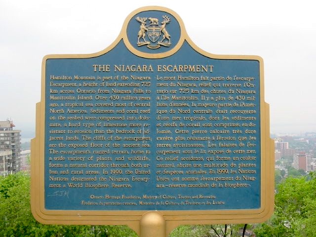
Photo by Alan L Brown - Posted June, 2004
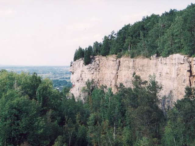
Photo by contributor Michael Anttila
Photo Source - Wikimedia Commons
Plaque Location
The City of Hamilton
At the north edge of the parking lot
at the north end of Highcliffe Avenue
Coordinates: N 43 14.707 W 79 51.967 |
Plaque Text
Hamilton Mountain is part of the Niagara Escarpment, a height of land extending 725 km across Ontario from Niagara Falls to Manitoulin Island. Over 430 million years ago, a tropical sea covered most of central North America. Sediments and coral reef on the seabed were compressed into dolomite, a hard type of limestone more resistant to erosion than the bedrock of adjacent lands. The cliffs of the escarpment are the exposed floor of the ancient sea. The escarpment's rugged terrain, home to a wide variety of plants and wildlife, forms a natural corridor through both urban and rural areas. In 1990, the United Nations designated the Niagara Escarpment a World Biosphere Reserve.
Related Ontario plaque
The Niagara Escarpment
More
Information
More
Landforms
More
Hamilton Plaques
Here are the visitors' comments for this page.
(none yet)
Here's where you can send me a comment for this page.
Note: Your email address will be posted at the end of your comment so others can respond to you unless you request otherwise.
Note: Comments are moderated. Yours will appear on this page within 24 hours (usually much sooner).
Note: As soon as I have posted your comment, a reply to your email will be sent informing you.
To send me your comment, click .
Thanks
Alan L Brown
Webmaster
Note: If you wish to send me a personal email, click .