Discover Ontario's history as told through its plaques
2004 - Now in our 12th Year - 2016
To see what's new on this site, you can visit the Home Page
Looking at this page on a smartphone?
For best viewing, hold your phone
in Landscape mode (Horizontal)
Blockhouse Island
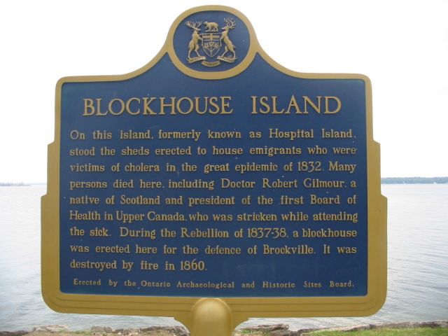
Photo by Alan L Brown - Posted June, 2004

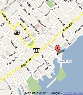
Photo from Google Street View ©2015 Google - Posted February, 2015
Plaque Location
The United Counties of Leeds & Grenville
The City of Brockville
On the east side of Blockhouse Island Parkway
south of Water Street, 1 block south of King Street
Coordinates: N 44 35.288 W 75 40.856 |
 |
Plaque Text
On this island, formerly known as Hospital Island, stood the sheds erected to house emigrants who were victims of cholera in the great epidemic of 1832. Many persons died here, including Doctor Robert Gilmour a native of Scotland and president of the first Board of Health in Upper Canada, who was stricken while attending the sick. During the Rebellion of 1837-38, a blockhouse was erected here for the defence of Brockville. It was destroyed by fire in 1860.
More
Information
More
Disasters
Here are the visitors' comments for this page.
(none yet)
Here's where you can sent me a comment for this page.
Note: Your email address will be posted at the end of your comment so others can respond to you unless you request otherwise.
Note: Comments are moderated. Yours will appear on this page within 24 hours (usually much sooner).
Note: As soon as I have posted your comment, a reply to your email will be sent informing you.
To send me your comment, click .
Thanks
Alan L Brown
Webmaster
Note: If you wish to send me a personal email, click .