Discover Ontario's history as told through its plaques
2004 - Now in our 13th Year - 2017
To see what's new on this site, you can visit the Home Page
Looking at this page on a smartphone?
For best viewing, hold your phone
in Landscape mode (Horizontal)
The Brockville Tunnel 1860
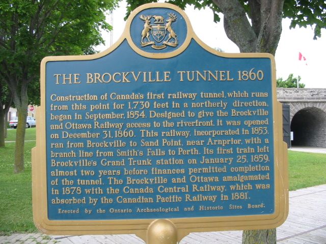
Photo by Alan L Brown - Posted June, 2005
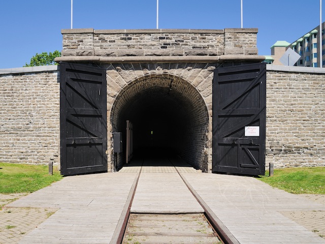
Photo by contributor Mark Earle - Posted October, 2011
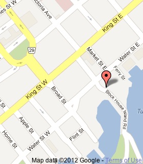
Plaque Location
The United Counties of Leeds & Grenville
The City of Brockville
Just to the west of these tunnel doors, beside the parking area
on Blockhouse Island Parkway, just south of Water Street
Coordinates: N 44 35.362 W 75 40.909 |
 |
Plaque Text
Construction of Canada's first railway tunnel, which runs from this point for 527 metres in a northerly direction, began in September 1854. Designed to give the Brockville and Ottawa Railway access to the riverfront, it was opened on December 31, 1860. This railway, incorporated in 1853, ran from Brockville to Sand Point, near Arnprior with a branch line from Smith's Falls to Perth. Its first train left Brockville's Grand Trunk station on January 25, 1859, almost two years before finances permitted completion of the tunnel. The Brockville and Ottawa amalgamated in 1878 with the Canada Central Railway, which was absorbed by the Canadian Pacific Railway in 1881.
More
Information
More
Railways
Here are the visitors' comments for this page.
(none yet)
Here's where you can sent me a comment for this page.
Note: Your email address will be posted at the end of your comment so others can respond to you unless you request otherwise.
Note: Comments are moderated. Yours will appear on this page within 24 hours (usually much sooner).
Note: As soon as I have posted your comment, a reply to your email will be sent informing you.
To send me your comment, click .
Thanks
Alan L Brown
Webmaster
Note: If you wish to send me a personal email, click .