Discover Ontario's history as told through its plaques
2004 - Now in our 11th Year - 2015
To see what's new on this site, you can visit the Home Page
The Founding of Spencerville
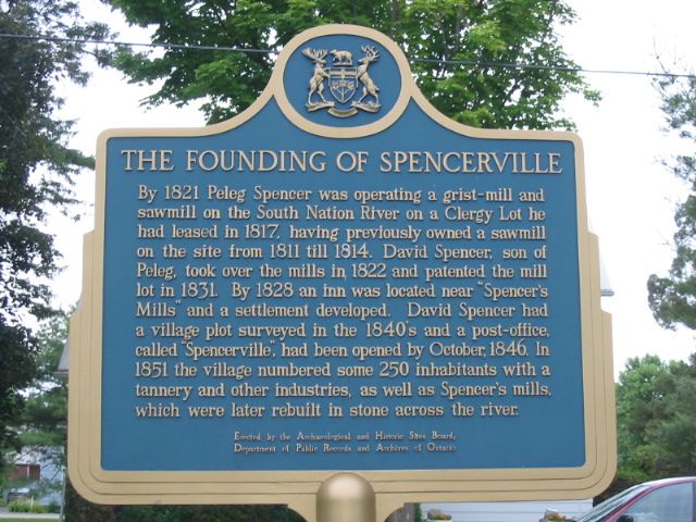
Photo by Alan L Brown - Posted July, 2005
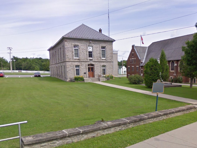
Photo from Google Street View ©2010 Google - Posted December, 2010
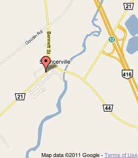
Plaque Location
The United Counties of Leeds & Grenville
The Township of Edwardsburgh/Cardinal
In Spencerville, on the north side of Road 21
street number 18, 2 blocks west of Road 44
Coordinates: N 44 50.538 W 75 32.879 |
 |
Plaque Text
By 1821 Peleg Spencer was operating a grist-mill and sawmill on the South Nation River on a Clergy Lot he had leased in 1817, having previously owned a sawmill on the site from 1811 till 1814. David Spencer, son of Peleg, took over the mills in 1822 and patented the mill lot in 1831. By 1828 an Inn was located near "Spencer's Mills" and a settlement developed. David Spencer had a village plot surveyed in the 1840's and a post-office, called "Spencerville", had been opened by October, 1846. In 1851 the village numbered some 250 inhabitants with a tannery and other industries, as well as Spencer's mills, which were later rebuilt in stone across the river.
More
Information
More
Settlements
More
Edwardsburgh/Cardinal Plaques
Here are the visitors' comments for this page.
(none yet)
Here's where you can sent me a comment for this page.
Note: If your comment includes a question, it's best to include your email address in your comment so others can respond to you.
Note: Comments are moderated. Yours will appear on this page within 24 hours (usually much sooner).
Note: As soon as I have posted your comment, a reply to your email will be sent informing you.
To send me your comment, click .
Thanks
Alan L Brown
Webmaster
Note: If you wish to send me a personal email, click the Email link in the Menu.