Discover Ontario's history as told through its plaques
2004 - Now in our 12th Year - 2016
To see what's new on this site, you can visit the Home Page
Looking at this page on a smartphone?
For best viewing, hold your phone
in Landscape mode (Horizontal)
Fort St. Pierre
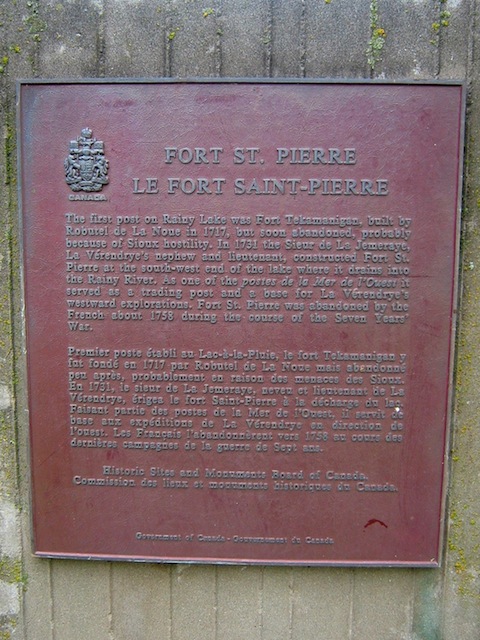
Photo by contributor Parks Canada - Posted December, 2011
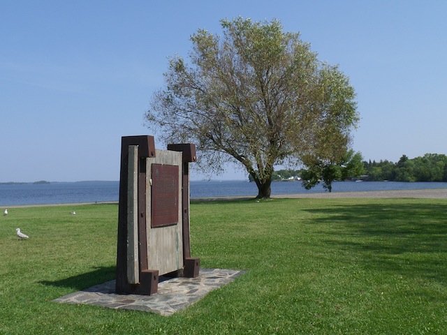
Photo by contributor Colin Old - Posted September, 2013
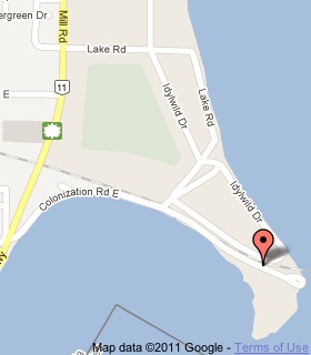
Plaque Location
The District of Rainy River
The Town of Fort Frances
In Pither's Point Park behind a ball diamond
Coordinates: N 48 36.900 W 93 21.383 |
 |
Plaque Text
The first post on Rainy Lake was Fort Tekamanigan, built by Robutel de La Noue in 1717, but soon abandoned, probably because of Sioux hostility. In 1731, Sieur de La Jemaraye, La Vérendrye's nephew and lieutenant, constructed Fort St. Pierre at the south-west end of the lake where it drains into the Rainy River. As one of the postes de la Mer de l 'Ouest it served as a trading post and base for La Vérendrye 's westward explorations. Fort St. Pierre was abandoned by the French about 1758 during the course of the Seven Years' War.
Related Ontario plaque
Sieur de La Vérendrye 1685-1749
More
Information
More
Trading Posts
Here are the visitors' comments for this page.
(none yet)
Here's where you can sent me a comment for this page.
Note: Your email address will be posted at the end of your comment so others can respond to you unless you request otherwise.
Note: Comments are moderated. Yours will appear on this page within 24 hours (usually much sooner).
Note: As soon as I have posted your comment, a reply to your email will be sent informing you.
To send me your comment, click .
Thanks
Alan L Brown
Webmaster
Note: If you wish to send me a personal email, click .