Discover Ontario's history as told through its plaques
2004 - Now in our 12th Year - 2016
To see what's new on this site, you can visit the Home Page
Looking at this page on a smartphone?
For best viewing, hold your phone
in Landscape mode (Horizontal)
The Pembroke and Mattawan Road
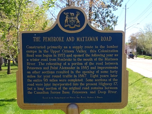
Photo by Alan L Brown - Posted July, 2005
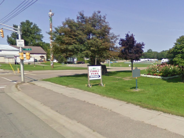
Photo from Google Street View ©2011 Google - Posted January, 2011
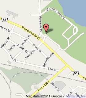
Plaque Location
The County of Renfrew
The City of Pembroke
In a park on the north side of Pembroke Street West
across from George Street
Coordinates: N 45 49.817 W 77 08.287 |
 |
Plaque Text
Constructed primarily as a supply route to the lumber camps in the Upper Ottawa Valley, this Colonization Road was begun in 1853 and opened the following year as a winter road from Pembroke to the mouth of the Mattawa River. The relocating of a portion of the road between Petawawa and Point Alexander in 1863 and improvements on other sections resulted in the opening of some 64 km for year round traffic in 1867. Eight years later the entire 158 km were completed. Some sections of the road were later incorporated into the present Highway 17, but a long section of the original road remains between the Canadian Forces Base Petawawa and Deep River.
More
Roads
More
Pembroke Plaques
Here are the visitors' comments for this page.
(none yet)
Here's where you can sent me a comment for this page.
Note: Your email address will be posted at the end of your comment so others can respond to you unless you request otherwise.
Note: Comments are moderated. Yours will appear on this page within 24 hours (usually much sooner).
Note: As soon as I have posted your comment, a reply to your email will be sent informing you.
To send me your comment, click .
Thanks
Alan L Brown
Webmaster
Note: If you wish to send me a personal email, click .