Discover Ontario's history as told through its plaques
2004 - Now in our 15th Year - 2019
To find out all about me, you can visit the Home Page
Looking at this page on a smartphone?
For best viewing, hold your phone
in Landscape mode (Horizontal)
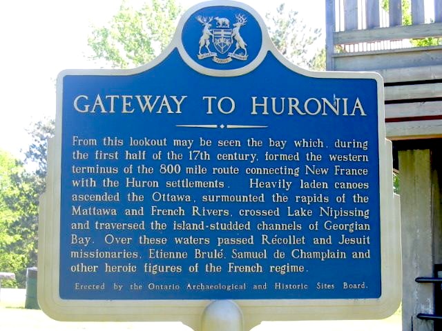
Gateway to Huronia
Photos by Alan L Brown - Posted June, 2004
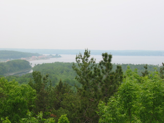
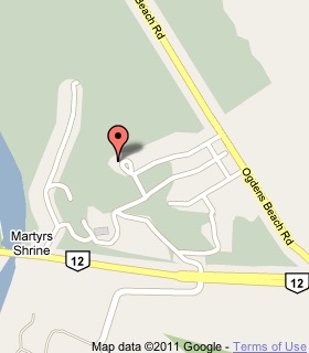
Plaque Location
The County of Simcoe
The Township of Tay
Beside a wooden lookout at the top of a hill
at the Martyrs' Shrine on the north side of Highway 12
just east of the Wye River bridge
Coordinates: N 44 44.313 W 79 50.483 |
 |
Plaque Text
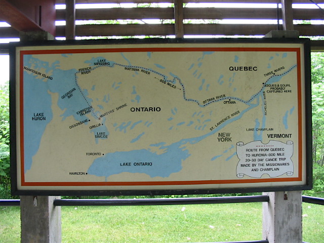
From this lookout may be seen the bay which, during the first half of the 17th century, formed the western terminus of the 1280 km route connecting New France with the Huron settlements. Heavily laden canoes ascended the Ottawa, surmounted the rapids of the Mattawa and French Rivers, crossed Lake Nipissing and traversed the island-studded channels of Georgian Bay. Over these waters passed Récollet and Jesuit missionaries, Etienne Brulé, Samuel de Champlain and other heroic figures of the French regime.
Related Ontario plaques
Sainte-Marie Among the Hurons (1639-1649)
Sainte-Marie II
Saint-Louis
Étienne Brûlé (c. 1592 - c. 1633)
Champlain's Journey of 1613
More
Canoe Routes
More
Tay Plaques
Here are the visitors' comments for this page.
(none yet)
Here's where you can send me a comment for this page.
Note: Your email address will be posted at the end of your comment so others can respond to you unless you request otherwise.
Note: Comments are moderated. Yours will appear on this page within 24 hours (usually much sooner).
Note: As soon as I have posted your comment, a reply to your email will be sent informing you.
To send me your comment, click .
Thanks
Alan L Brown
Webmaster
Note: If you wish to send me a personal email, click .