Ontario's Provincial Plaques
Here's where you can learn a little Ontario history.
Ripple Rock
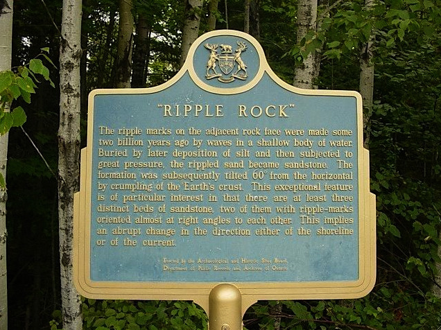
Photo by John Carman Shultis - July 6, 2006
Photo by Ron Schott - July 20, 2002
Plaque Location
The District of Algoma
The Township of Johnson
Near the rock outcropping, Highway 17, about 2.5 km west of Desbarats and 4 km east of Highway 548
Plaque Text
The ripple marks on the adjacent rock face were made some two billion years ago by waves in a shallow body of water. Buried by later deposition of silt and then subjected to great pressure, the rippled sand became sandstone. The formation was subsequently tilted 60 degrees from the horizontal by crumpling of the Earth's crust. This exceptional feature is of particular interest in that there are at least three distinct beds of sandstone, two of them with ripple-marks oriented almost at right angles to each other. This implies an abrupt change in the direction either of the shoreline of of the current.
Here's More
Landforms
Here are the comments for this page.
(none yet)
Write a comment for this page.
(Note: If you wish to ask me a question, please use the email link in the menu.)
Note: Comments are moderated. Yours will appear on this page within 24 hours (usually much sooner).