Ontario's Historical Plaques
at ontarioplaques.com
Learn a little Ontario history as told through its plaques
Sault Ste. Marie Ship Canal
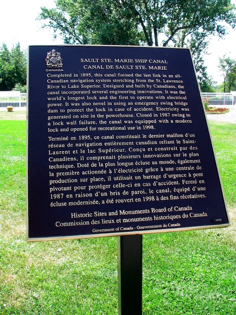
Photo by contributor Bill McKibbon - Posted October, 2011
Photo Source - Wikimedia Commons
Plaque Location
The District of Algoma
The City of Sault Ste. Marie
Beside the canal off Canal Drive
Coordinates: N 46 30.785 W 84 21.026 |
Plaque Text
Completed in 1895, this canal formed the last link in an all-Canadian navigation system stretching from the St. Lawrence River to Lake Superior. Designed and built by Canadians, the canal incorporated several engineering innovations. It was the world's longest lock and the first to operate with electrical power. It was also novel in using an emergency swing bridge dam to protect the lock in case of accident. Electricity was generated on site in the powerhouse. Closed in 1987 owing to a lock wall failure, the canal was equipped with a modern lock and opened for recreational use in 1998.
Related Ontario plaque page
The First Sault Ste. Marie Canal
More
Information
More
Canals
Here are the visitors' comments for this page.
(none yet)
Here's where you can write a comment for this page.
Note: If you wish to ask me a question, please use the email link in the menu.
Note: Comments are moderated. Yours will appear on this page within 24 hours
(usually much sooner).