Ontario's Historical Plaques
at ontarioplaques.com
Learn a little Ontario history as told through its plaques
The Founding of Paisley
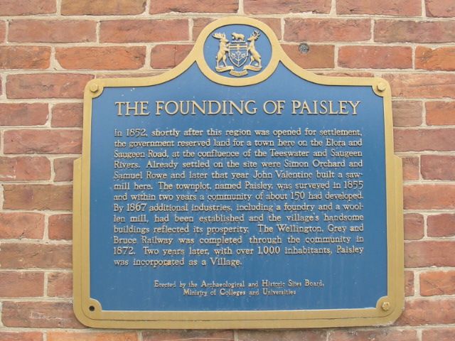
Photo by Alan L Brown - Posted June, 2005
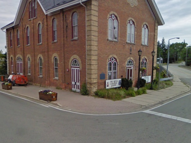
Photo from Google Street View ©2011 Google - Posted January, 2011
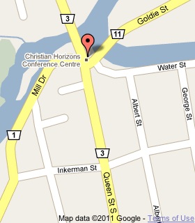
Plaque Location
The County of Bruce
The Municipality of Arran-Elderslie
In Paisley, on the south wall of a building on the northeast corner of
Queen Street (Road 3) and Goldie Street (Road 11)
Coordinates: N 44 18.378 W 81 16.362 |
 |
Plaque Text
In 1852, shortly after this region was opened for settlement, the government reserved land for a town here on the Elora and Saugeen Road, at the confluence of the Teeswater and Saugeen Rivers. Already settled on the site were Simon Orchard and Samuel Rowe and later that year John Valentine built a saw-mill here. The townplot, named Paisley, was surveyed in 1855 and within two years a community of about 150 had developed. By 1867 additional industries, including a foundry and a woollen mill had been established and the village's handsome buildings reflected its prosperity. The Wellington, Grey and Bruce Railway was completed through the community in 1872. Two years later, with over 1,000 inhabitants, Paisley was incorporated as a Village.
More
Information
More
Settlements
Here are the visitors' comments for this page.
(none yet)
Here's where you can write a comment for this page.
Note: If you wish to ask me a question, please use the email link in the menu.
Note: Comments are moderated. Yours will appear on this page within 24 hours
(usually much sooner).
Note: As soon as the comment is posted, a link to it will appear on the home page in the section "Here are the 10 latest plaque pages with a new comment added by a visitor to this site."