Ontario's Historical Plaques
at ontarioplaques.com
Learn a little Ontario history as told through its plaques
The Founding of Wiarton
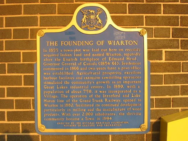
Photo by Alan L Brown - Posted June, 2005
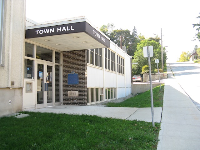
Photo by contributor Wayne Adam - Posted October, 2011
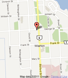
Plaque Location
The County of Bruce
The Town of South Bruce Peninsula
In Wiarton, at the town hall entrance on George Street
near the southwest corner with Bedford Street (Highway 6)
Coordinates: N 44 44.510 W 81 08.473 |
 |
Plaque Text
In 1855 a town-plot was laid out here on recently acquired Indian land and named Wiarton, reputedly after the English birthplace of Edmund Head, Governor General of Canada (1854-61). Settlement commenced in 1866 and two years later a post-office was established. Agricultural prosperity, excellent harbour facilities and extensive sawmilling operations stimulated the community's growth as an important Great Lakes industrial centre. In 1880, with a population of about 750, it was incorporated as a Village. The operation of the Stratford and Lake Huron line of the Grand Trunk Railway, opened to Wiarton in 1882, facilitated its continued development particularly in milling and the manufacturers of wood products. With over 2,000 inhabitants, the thriving community became a Town in 1894.
More
Information
More
Settlements
Here are the visitors' comments for this page.
(none yet)
Here's where you can write a comment for this page.
Note: If you wish to ask me a question, please use the email link in the menu.
Note: Comments are moderated. Yours will appear on this page within 24 hours
(usually much sooner).
Note: As soon as the comment is posted, a link to it will appear on the home page in the section "Here are the 10 latest plaque pages with a new comment added by a visitor to this site."