Here's where you can learn a little Ontario history
The Founding of Blenheim
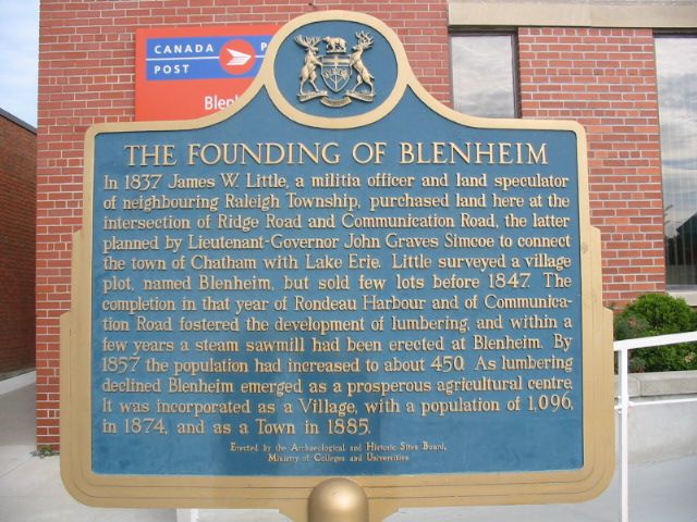
Photo by Alan L Brown - August, 2004
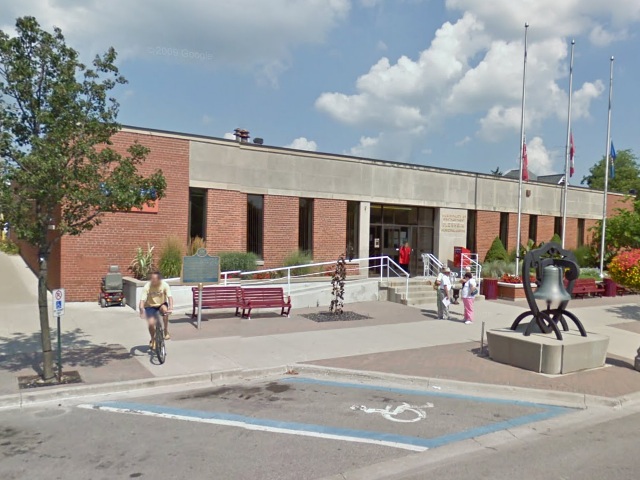
Photo from Google Street View ©2011 Google - January, 2011
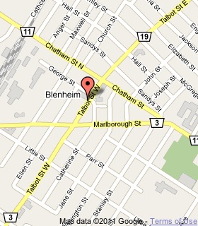
Plaque Location
The Municipality of Chatham-Kent
In Blenheim, on the northwest corner of
Talbot Street West and George Street
Coordinates: N 42 20.078 W 81 59.902 |
 |
Plaque Text
In 1837 James W. Little, a militia officer and land speculator of neighbouring Raleigh Township, purchased land here at the intersection of Ridge Road and Communication Road, the latter planned by Lieutenant-Governor John Graves Simcoe to connect the town of Chatham with Lake Erie. Little surveyed a village plot, named Blenheim, but sold few lots before 1847. The completion in that year of Rondeau Harbour and of Communication Road fostered the development of lumbering and within a few years a steam sawmill had been erected at Blenheim. By 1857 the population had increased to about 450. As lumbering declined Blenheim emerged as a prosperous agricultural centre. It was incorporated as a Village, with a population of 1,096, in 1874, and as a Town in 1885.
More
Information
More
Settlements
Here are the comments for this page.
(none yet)
Here's where you can write a comment for this page.
Note: If you wish to ask me a question, please use the email link in the menu.
Note: Comments are moderated. Yours will appear on this page within 24 hours
(usually much sooner).