Ontario's Historical Plaques
at ontarioplaques.com
Learn a little Ontario history as told through its plaques
Porcupine Mining Area
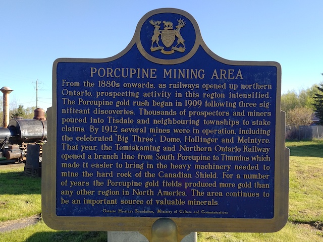
Photo by contributor Debbie Gagain and Robert Staniforth - Posted October, 2005
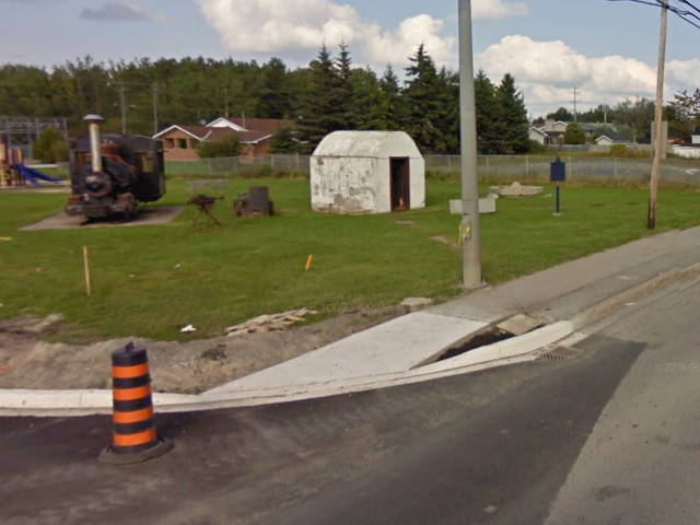
Photo from Google Street View ©2010 Google - Posted September, 2010
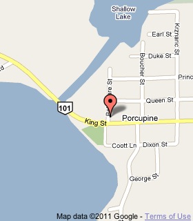
Plaque Location
The District of Cochrane
The City of Timmins
In Porcupine, at the northeast corner of King Street (Highway 101) and Bellemare Street
Coordinates: N 48 29.661 W 81 10.320 |
 |
Plaque Text
From the 1880s onwards, as railways opened up northern Ontario, prospecting activity in this region intensified. The Porcupine gold rush began in 1909 following three significant discoveries. Thousands of prospectors and miners poured into Tisdale and neighbouring townships to stake claims. By 1912 several mines were in operation, including the celebrated "Big Three": Dome, Hollinger and McIntyre. That year, the Temiskaming and Northern Ontario Railway opened a branch line from South Porcupine to Timmins which made it easier to bring in the heavy machinery needed to mine the hard rock of the Canadian Shield. For a number of years the Porcupine gold fields produced more gold than any other region in North America. The area continues to be an important source of valuable minerals.
More
Information
More
Mining
Here are the visitors' comments for this page.
(none yet)
Here's where you can write a comment for this page.
Note: If you wish to ask me a question, please use the email link in the menu.
Note: Comments are moderated. Yours will appear on this page within 24 hours
(usually much sooner).