Here's where you can learn a little Ontario history
The Founding of Iroquois Falls
Photos by contributor Albert Joseph - July, 2011
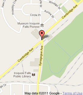
Plaque Location
The District of Cochrane
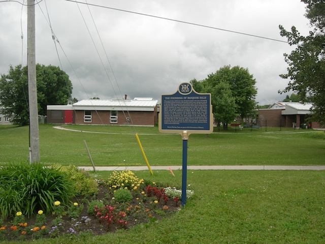
Town of Iroquois Falls
On the north-west corner of
Cambridge Avenue and Synagogue Avenue
Coordinates: N 48 45.822 W 80 40.916 |
 |
Plaque Text
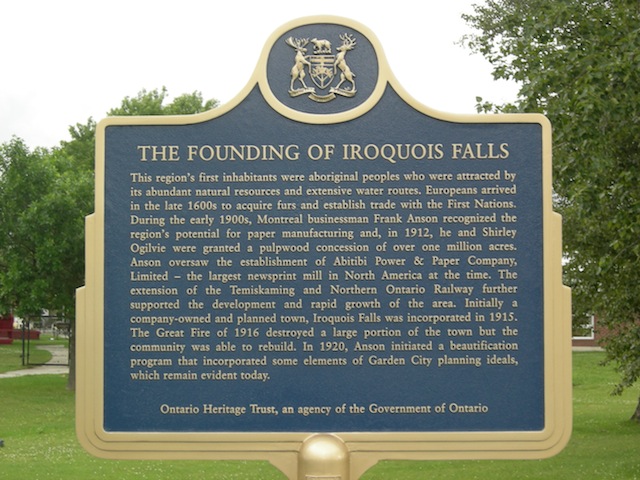
This region's first inhabitants were aboriginal peoples who were attracted by its abundant natural resources and extensive water routes. Europeans arrived in the late 1600s to acquire furs and establish trade with the First Nations. During the early 1900s, Montreal businessman Frank Anson recognized the region's potential for paper manufacturing and, in 1912, he and Shirley Ogilvie were granted a pulpwood concession of over 400,000 ha. Anson oversaw the establishment of Abitibi Power & Paper Company, Limited - the largest newsprint mill in North America at the time. The extension of the Temiskaming and Northern Ontario Railway further supported the development and rapid growth of the area. Initially a company-owned and planned town, Iroquois Falls was incorporated in 1915. The Great Fire of 1916 destroyed a large portion of the town but the community was able to rebuild. In 1920, Anson initiated a beautification program that incorporated some elements of Garden City planning ideals, which remain evident today.
Related Ontario plaque page
Great Fire of 1916
More
Information
More
Settlements
Here are the comments for this page.
(none yet)
Here's where you can write a comment for this page.
Note: If you wish to ask me a question, please use the email link in the menu.
Note: Comments are moderated. Yours will appear on this page within 24 hours
(usually much sooner).