Ontario's Historical Plaques
at ontarioplaques.com
Learn a little Ontario history as told through its plaques
The Talbot Road
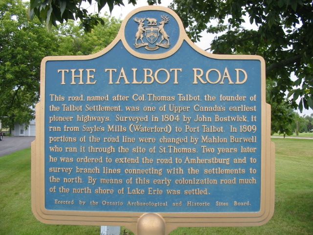
Photo by Alan L Brown - Posted August, 2004
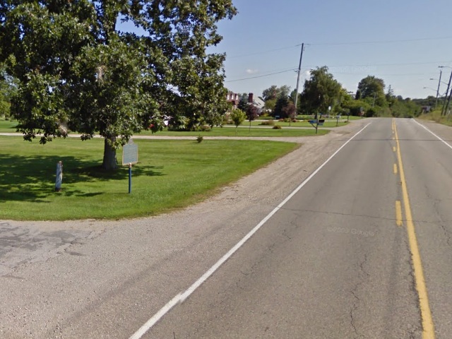
Photo from Google Street View ©2011 Google - Posted January, 2011
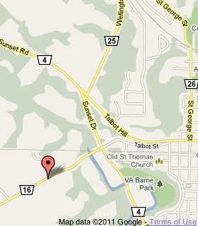
Plaque Location
The County of Elgin
The City of St. Thomas
On the north side of Fingall Line (Road 16), 630 m west of Road 4,
street number 40012
Coordinates: N 42 46.541 W 81 13.141 |
 |
Plaque Text
This road, named after Col. Thomas Talbot, the founder of the Talbot Settlement, was one of Upper Canada's earliest pioneer highways. Surveyed in 1804 by John Bostwick, it ran from Sayle's Mills (Waterford) to Port Talbot. In 1809 portions of the road line were changed by Mahlon Burwell who ran it through the site of St. Thomas. Two years later he was ordered to extend the road to Amherstburg and to survey branch lines connecting with the settlements to the north. By means of this early colonization road much of the north shore of Lake Erie was settled.
Related Ontario plaques
Colonel The Honourable Thomas Talbot 1771-1853
The Talbot Settlement
Lieutenant-Colonel Mahlon Burwell 1783-1846
More
Information
More
Roads
Here are the visitors' comments for this page.
(none yet)
Here's where you can write a comment for this page.
Note: If you wish to ask me a question, please use the email link in the menu.
Note: Comments are moderated. Yours will appear on this page within 24 hours
(usually much sooner).
Note: As soon as the comment is posted, a link to it will appear on the home page in the section "Here are the 10 latest plaque pages with a new comment added by a visitor to this site."