Ontario's Historical Plaques
at ontarioplaques.com
Learn a little Ontario history as told through its plaques
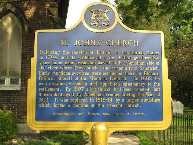
St. John's Church
Photos by contributor Wayne Adam - Posted September, 2011
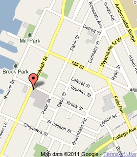
Plaque Location
The County of Essex
The City of Windsor
On the southeast corner of Sandwich Street and Brock Street
Coordinates: N 42 17.973 W 83 04.618 |
 |
Plaque Text
Following the cession of Detroit to the United States in 1794, and the withdrawal of the British garrison two years later, many residents moved to the Canadian side of the river where they founded the community of Sandwich. Early Anglican services were conducted there by Richard Pollard, sheriff of the Western District. In 1802 he was ordained a deacon and appointed missionary to the settlement. By 1807, a log church had been erected, but it was destroyed by American troops during the War of 1812. It was replaced in 1818-19 by a larger structure which forms a portion of the present church.
More
Churches
Here are the visitors' comments for this page.
(none yet)
Here's where you can write a comment for this page.
Note: If you wish to ask me a question, please use the email link in the menu.
Note: Comments are moderated. Yours will appear on this page within 24 hours
(usually much sooner).
Note: As soon as the comment is posted, a link to it will appear on the home page in the section "Here are the 10 latest plaque pages with a new comment added by a visitor to this site."