Ontario's Historical Plaques
at ontarioplaques.com
Learn a little Ontario history as told through its plaques
The Frontenac Road
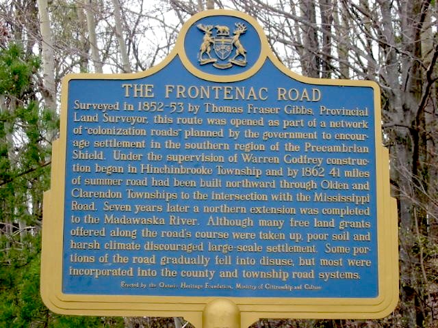
Photo by Alan L Brown - Posted June, 2004
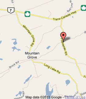
Plaque Location
The County of Frontenac
The Township of Central Frontenac
From Highway 7, 28 km east of Kaladar
follow Frontenac Road south
bearing left at the first split in the road
then 1 km to Ferguson Road (SW corner)
Coordinates: N 44 44.537 W 76 49.695 |
 |
Plaque Text
Surveyed in 1852-53 by Thomas Fraser Gibbs, Provincial Land Surveyor, this route was opened as part of a network of "colonization roads" planned by the government to encourage settlement in the southern region of the Precambrian Shield. Under the supervision of Warren Godfrey construction began in Hinchinbrooke Township and by 1862 66 km of summer road had been built northward through Olden and Clarendon Townships to the intersection with the Mississippi Road. Seven years later a northern extension was completed to the Madawaska River. Although many free land grants offered along the road's course were taken up, poor soil and harsh climate discouraged large-scale settlement. Some portions of the road gradually fell into disuse, but most were incorporated into the county and township road systems.
More
Information
More
Roads
Here are the visitors' comments for this page.
Posted December 3, 2010
I am a new (visit time to time) visitor in this nice pristine environment. I wish we will keep this ecosystem as is. While I was reading the above plaque I was just trying to figure out the time and situation those great mans sacrificed for us. With due respect to them I will say "we should be greatful to them".
Masud, Dec.03.2010, Toronto
Posted January 21, 2010
I travelled this road, and stopped to take photo's of this plaque. Warren Godfrey who was in charge of the construction of this road, was my Great-Great-Grandfather. Is there anywhere I can get more in-depth information about the building of this road. I do have an old letter, written many years ago from one aunt to another, where she tells of how Warren had to befriend the Indians of the territories to have safe passage for his workers, etc. She said he was given gifts of beautiful beaded bucksking jackets and boots. I guess construction was in the Godfrey blood, as one of his grandsons, My grandfather T.J. Godfrey was responsible for gaining government grants and was also in charge of the construction for the first highway from Chapleau Ontario down to Hwy 17, allowing automobile passage there rather than having to use the train only. His Brother, Damon Godfrey was drowned working on the locks at Sault Ste. Marie where he was also in charge of the construction there.
Vivian Bloom
Posted August 28, 2009
explored this route this afternoon on our way home to Kingston from Bon Echo Park. Very interesting.
Here's where you can write a comment for this page.
Note: If you wish to ask me a question, please use the email link in the menu.
Note: Comments are moderated. Yours will appear on this page within 24 hours
(usually much sooner).
Note: As soon as the comment is posted, a link to it will appear on the home page in the section "Here are the 10 latest plaque pages with a new comment added by a visitor to this site."