Ontario's Historical Plaques
at ontarioplaques.com
Learn a little Ontario history as told through its plaques
The Founding of Hanover
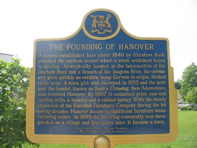
Photo by Alan L Brown - Posted June, 2005
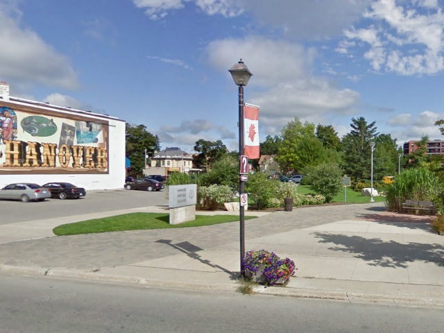
Photo from Google Street View ©2011 Google - Posted February, 2011
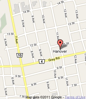
Plaque Location
The County of Grey
The Town of Hanover
In Hanover Heritage Square on the northwest corner of
10th Street (Road 4) and 11th Avenue
Coordinates: N 44 09.152 W 81 01.546 |
 |
Plaque Text
A tavern established here about 1849 by Abraham Buck provided the nucleus around which a small settlement began to develop. Strategically located at the intersection of the Durham Road and a branch of the Saugeen River, the community grew quickly as settlers, many German in origin, flocked to the area. A town plot was surveyed in 1855 and the next year the hamlet, known as Buck's Crossing, then Adamstown, was renamed Hanover. By 1867 it contained grist, saw and carding mills, a foundry and a cabinet factory. With the steady expansion of the Knechtel Furniture Company during the following decades, Hanover became a significant furniture manufacturing centre. In 1899 the thriving community was incorporated as a village and five years later it became a town.
Related Ontario plaque
The Durham Road
More
Information
More
Settlements
Here are the visitors' comments for this page.
(none yet)
Here's where you can write a comment for this page.
Note: If you wish to ask me a question, please use the email link in the menu.
Note: Comments are moderated. Yours will appear on this page within 24 hours
(usually much sooner).