Ontario's Historical Plaques
at ontarioplaques.com
Learn a little Ontario history as told through its plaques
Founding of Meaford
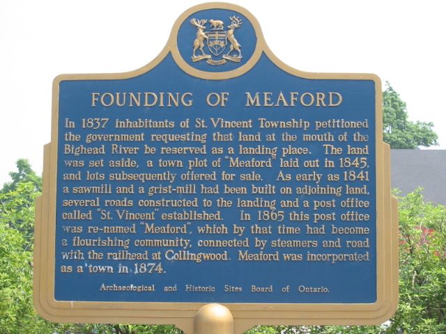
Photo by Alan L Brown - Posted June, 2005
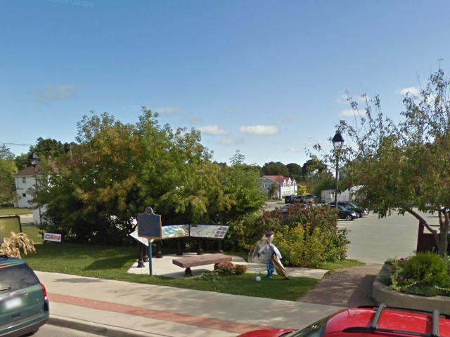
Photo from Google Street View ©2011 Google - Posted February, 2011
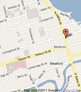
Plaque Location
The County of Grey
The Municipality of Meaford
On the southeast corner of North Sykes Street (Highway 26) and Collingwood Street
Coordinates: N 44 36.528 W 80 35.541 |
 |
Plaque Text
In 1837 inhabitants of St. Vincent Township petitioned the government requesting that land at the mouth of the Bighead River be reserved as a landing place. The land was set aside, a town plot of "Meaford" laid out in 1845, and lots subsequently offered for sale. As early as 1841 a sawmill and a grist-mill had been built on adjoining land, several roads constructed to the landing and a post office called "St. Vincent" established. In 1865 this post office was re-named "Meaford", which by that time had become a flourishing community, connected by steamer and road with the railhead at Collingwood. Meaford was incorporated as a town in 1874.
More
Information
More
Settlements
Here are the visitors' comments for this page.
(none yet)
Here's where you can write a comment for this page.
Note: If you wish to ask me a question, please use the email link in the menu.
Note: Comments are moderated. Yours will appear on this page within 24 hours
(usually much sooner).