Ontario's Historical Plaques
at ontarioplaques.com
Learn a little Ontario history as told through its plaques
The Newash Indian Village 1842
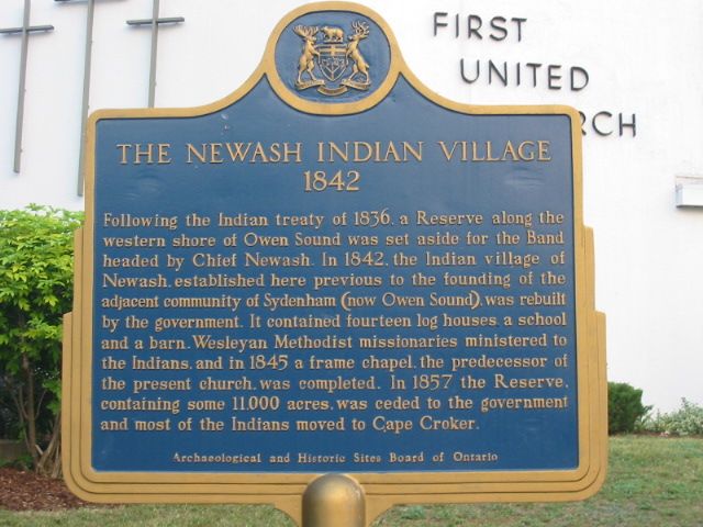
Photo by Alan L Brown - Posted June, 2005
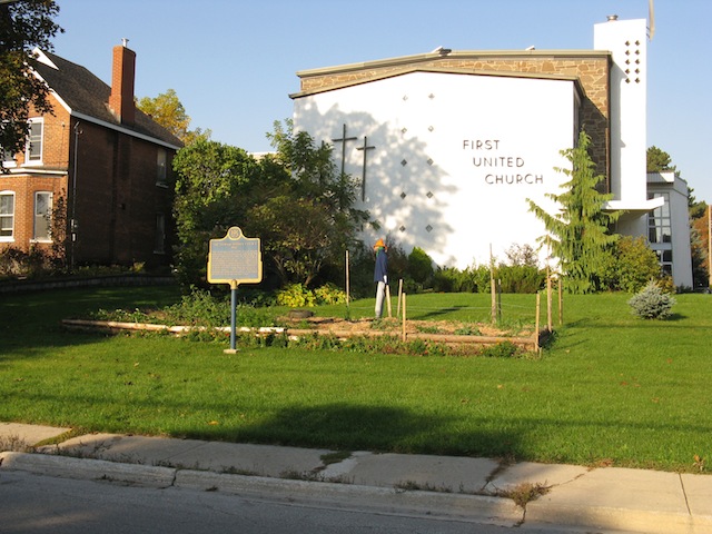
Photo by contributor Wayne Adam - Posted October, 2011
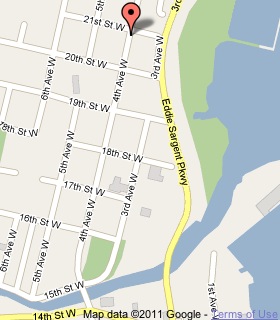
Plaque Location
The County of Grey
The City of Owen Sound
On the southwest corner of
4th Avenue West and 21st Street West
Coordinates: N 44 34.949 W 80 56.963 |
 |
Plaque Text
Following the Indian treaty of 1836, a Reserve along the western shore of Owen Sound was set aside for the Band headed by Chief Newash. In 1842, the Indian village of Newash, established here previous to the founding of the adjacent community of Sydenham (now Owen Sound), was rebuilt by the government. It contained fourteen log houses, a school and a barn. Wesleyan Methodist missionaries ministered to the Indians, and in 1845 a frame chapel, the predecessor of the present church, was completed. In 1857 the Reserve, containing some 4,450 ha, was ceded to the government and most of the Indians moved to Cape Croker.
Related Ontario plaques
The Founding of Owen Sound
Credit Indian Village
Crawford Lake Indian Village Site
The Lawson Site
The Nodwell Indian Village Site
Roebuck Indian Village Site
More
First Nations
Here are the visitors' comments for this page.
(none yet)
Here's where you can write a comment for this page.
Note: If you wish to ask me a question, please use the email link in the menu.
Note: Comments are moderated. Yours will appear on this page within 24 hours
(usually much sooner).
Note: As soon as the comment is posted, a link to it will appear on the home page in the section "Here are the 10 latest plaque pages with a new comment added by a visitor to this site."