Ontario's Historical Plaques
at ontarioplaques.com
Learn a little Ontario history as told through its plaques
"The Old Mail Road"
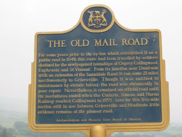
Photo by Alan L Brown - Posted June, 2005
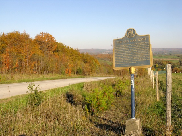
Photo by contributor Wayne Adam - Posted October, 2011
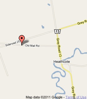
Plaque Location
The County of Grey
The Town of The Blue Mountains
On the south side of Old Mail Road
1 km west of the village of Heathcote on Road 13
Coordinates: N 44 30.081 W 80 30.260 |
 |
Plaque Text
For some years prior to the by-law which established it as a public road in 1846, this route had been travelled by settlers destined for the newly-opened townships of Osprey, Collingwood, Euphrasia and St. Vincent. From its junction near Duntroon with an extension of the Sunnidale Road, it ran some 34 km northwesterly to Griersville. Though it was entitled to maintenance by statute labour, the road was chronically in poor repair. Nevertheless, it remained an official road until its usefulness ended when the Ontario, Simcoe and Huron Railway reached Collingwood in 1855. Save for this 8 km section still in use between Griersville and Heathcote, little evidence remains of the pioneer road.
More
Roads
Here are the visitors' comments for this page.
Posted December 1, 2010
Hi my name is Jeromy currie I have just moved to Duntroon Ontario and i live on sydenham trail which is part of the OLD MAIL ROAD, the house that i have is an old anglican rectory that was built by the church in 1882 and im trying to find any info on the house and the old mail road. If you have any info or pics I would love to see them thanks J Currie
Here's where you can write a comment for this page.
Note: If you wish to ask me a question, please use the email link in the menu.
Note: Comments are moderated. Yours will appear on this page within 24 hours
(usually much sooner).
Note: As soon as the comment is posted, a link to it will appear on the home page in the section "Here are the 10 latest plaque pages with a new comment added by a visitor to this site."