Ontario's Historical Plaques
at ontarioplaques.com
Learn a little Ontario history as told through its plaques
The Toronto-Sydenham Road
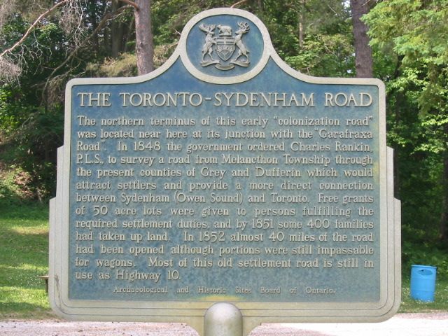
Photo by Alan L Brown - Posted June, 2005
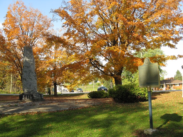
Photo by contributor Wayne Adam - Posted October, 2011
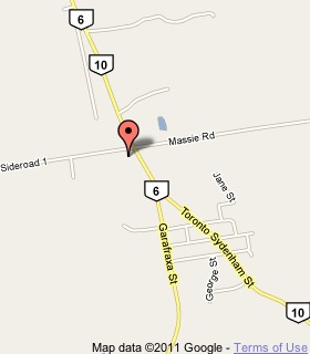
Plaque Location
The County of Grey
The Township of Chatsworth
In Chatsworth, in a park on the west side of Highway 10
just south of Sideroad 1 / Massie Road
Coordinates: N 44 27.488 W 80 54.018 |
 |
Plaque Text
The northern terminus of this early "colonization road" was located near here at its junction with the "Garafraxa Road". In 1848 the government ordered Charles Rankin, P.L.S., to survey a road from Melancthon Township through the present counties of Grey and Dufferin which would attract settlers and provide a more direct connection between Sydenham (Owen Sound) and Toronto. Free grants of 20 ha lots were given to persons fulfilling the required settlement duties, and by 1851 some 400 families had taken up land. In 1852 almost 64 km of the road had been opened although portions were still impassable for wagons. Most of this old settlement road is still in use as Highway 10.
Related Ontario plaque
Charles Rankin 1797-1886
More
Roads
Here are the visitors' comments for this page.
(none yet)
Here's where you can write a comment for this page.
Note: If you wish to ask me a question, please use the email link in the menu.
Note: Comments are moderated. Yours will appear on this page within 24 hours
(usually much sooner).