Here's where you can learn a little Ontario history
The Founding of Dunnville
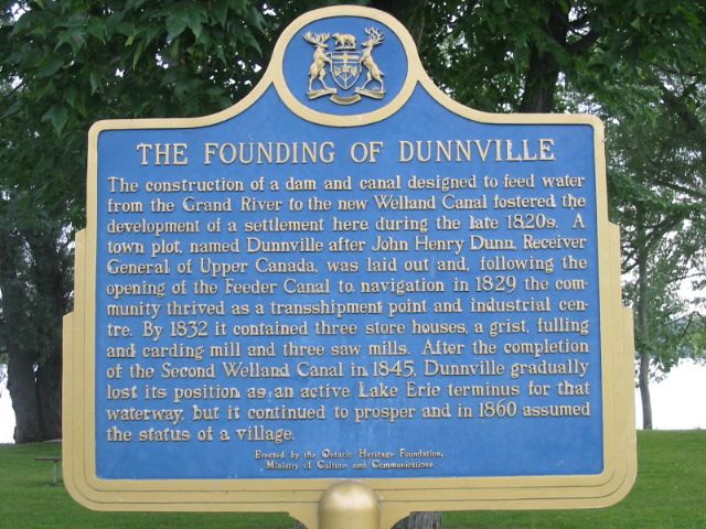
Photo by Alan L Brown - August, 2004
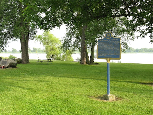
Photo by contributor Wayne Adam - October, 2010
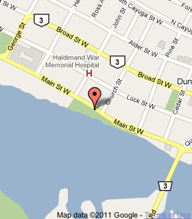
Plaque Location
The County of Haldimand
In Dunnville, on the river side of Main Street West
north of the bridge across from Church Street
Coordinates: N 42 54.196 W 79 37.478 |
 |
Plaque Text
The construction of a dam and canal designed to feed water from the Grand River to the new Welland Canal fostered the development of a settlement here during the late 1820s. A town plot, named Dunnville after John Henry Dunn, Receiver General of Upper Canada, was laid out and, following the opening of the Feeder Canal to navigation in 1829 the community thrived as a transshipment point and industrial centre. By 1832 it contained three store houses, a grist, fulling and carding mill and three saw mills. After the completion of the Second Welland Canal in 1845, Dunnville gradually lost its position as an active Lake Erie terminus for that waterway, but it continued to prosper and in 1860 assumed the status of a village.
More
Information
More
Settlements
Here are the comments for this page.
(none yet)
Here's where you can write a comment for this page.
Note: If you wish to ask me a question, please use the email link in the menu.
Note: Comments are moderated. Yours will appear on this page within 24 hours
(usually much sooner).