Here's where you can learn a little Ontario history
Founding of Haliburton
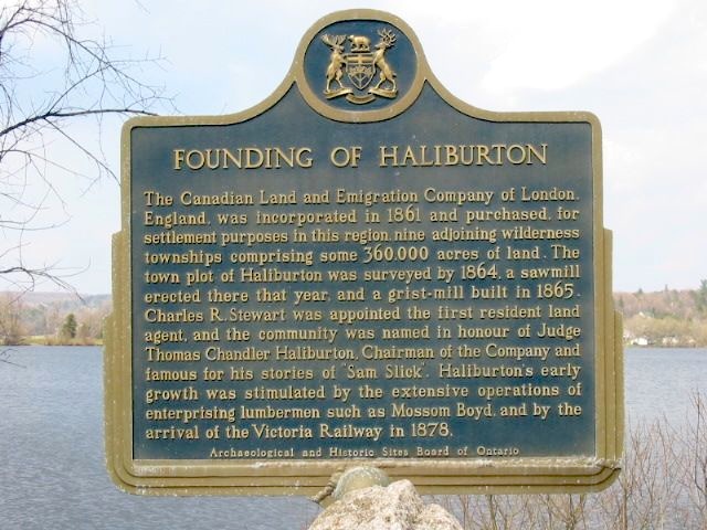
Photo by Alan L Brown - May, 2005
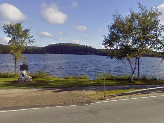
Photo from Google Street View ©2010 Google - September, 2010
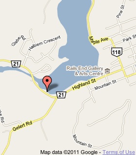
Plaque Location
The County of Haliburton
Municipality of Dysart et al
In Haliburton, in a park on the north side of Road 21
on the shore of Head Lake just west of Road 1
Coordinates: N 45 02.609 W 78 31.327 |
 |
Plaque Text
The Canadian Land and Emigration Company of London, England, was incorporated in 1861 and purchased for settlement purposes in this region, nine adjoining wilderness townships comprising some 145,700 ha of land. The townplot of Haliburton was surveyed by 1864, a sawmill erected there that year, and a grist-mill built in 1865. Charles R. Stewart was appointed the first resident land agent, and the community was named in honour of Judge Thomas Chandler Haliburton. Chairman of the Company and famous for his stories of "Sam Slick". Haliburton's early growth was stimulated by the extensive operations of enterprising lumbermen such as Mossom Boyd, and by the arrival of the Victoria Railway in 1878.
More
Settlements
Here are the comments for this page.
(none yet)
Here's where you can write a comment for this page.
Note: If you wish to ask me a question, please use the email link in the menu.
Note: Comments are moderated. Yours will appear on this page within 24 hours
(usually much sooner).