Ontario's Historical Plaques
at ontarioplaques.com
Learn a little Ontario history as told through its plaques
Dundas Street
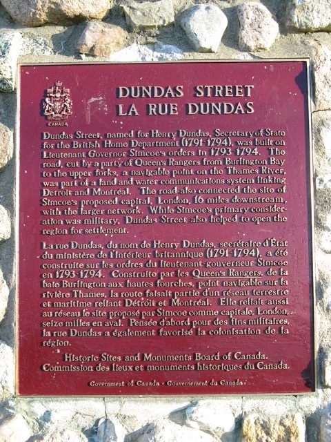
Photo by contributor Wayne Adam - Posted June, 2009
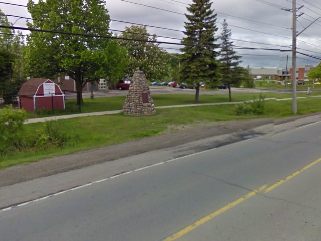
Photo from Google Street View ©2011 Google - Posted March, 2011
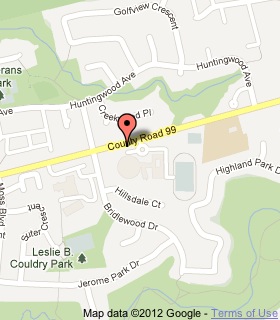
Plaque Location
The City of Hamilton
On a cairn on the south side of Governor's Road
east of Bridlewood Drive, in front of Highland High School
Coordinates: N 43 15.507 W 79 58.630 |
 |
Plaque Text
Dundas Street, named for Henry Dundas, Secretary of State for the British Home Department (1791-1794), was built on Lieutenant Governor Simcoe's orders in 1793-1794. The road, cut by a party of Queen's Rangers from Burlington Bay to the upper forks, a navigable point on the Thames River, was part of a land and water communications system linking Detroit and Montreal. The road also connected the site of Simcoe's proposed capital, London, 26 km downstream, with the larger network. While Simcoe's primary consideration was military, Dundas Street also helped to open the region for settlement.
Related Ontario plaques
Dundas Mills
The Dundas Town Hall
The Founding of Dundas
More
Roads
Here are the visitors' comments for this page.
(none yet)
Here's where you can write a comment for this page.
Note: If you wish to ask me a question, please use the email link in the menu.
Note: Comments are moderated. Yours will appear on this page within 24 hours
(usually much sooner).
Note: As soon as the comment is posted, a link to it will appear on the home page in the section "Here are the 10 latest plaque pages with a new comment added by a visitor to this site."