Here's where you can learn a little Ontario history
Champlain's War Party, 1615
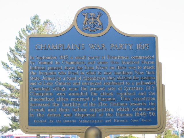
Photo by Alan L Brown - May, 2004
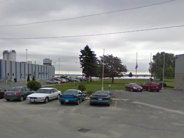
Photo from Google Street View ©2010 Google - December, 2010

Photo Source - Wikipedia
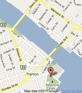
Plaque Location
The County of Hastings
The City of Quinte West
In Trenton, on the southwest corner of
Quinte Street and Albert Street, near some flagpoles
Coordinates: N 44 05.993 W 77 34.486 |
 |
Plaque Text
In September, 1615, a small party of Frenchmen, commanded by Samuel de Champlain, and some five hundred Huron Indians passed down the Trent River on their way to attack the Iroquois who lived in what is now northern New York State. Joined by a band of Algonkians they skirted the eastern end of Lake Ontario and journeyed southward to a palisaded Onondaga village near the present site of Syracuse, N.Y. Champlain was wounded, the attack repulsed, and the discomfited allies returned to Huronia. This expedition increased the hostility of the Five Nations towards the French and their Indian supporters, which culminated in the defeat and dispersal of the Hurons, 1649-50.
Related Ontario plaque pages
Champlain's Astrolabe
Champlain's Journey of 1613
Samuel de Champlain (died in 1635)
Samuel de Champlain
Related Toronto plaque page
Samuel de Champlain's Journeys Through Ontario
More
Information
More
Explorers
Here are the comments for this page.
Posted March 27, 2010
the plaque script appears OK but what you have on this pages write up says 1605 - should be 1615 I think. [Thanks. I've now fixed it.]
Here's where you can write a comment for this page.
Note: If you wish to ask me a question, please use the email link in the menu.
Note: Comments are moderated. Yours will appear on this page within 24 hours
(usually much sooner).