Ontario's Historical Plaques
at ontarioplaques.com
Learn a little Ontario history as told through its plaques
The Peterson Road
There are two plaques about this road.
The first is in the County of Hastings.
The second is in the District of Muskoka.
Both can be seen on this page.
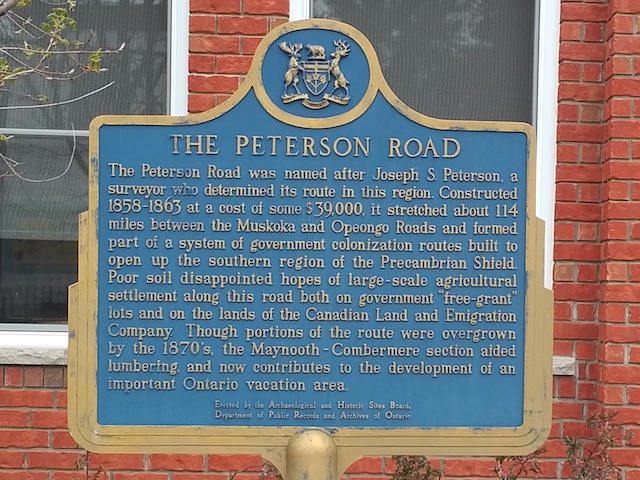
Photo by Alan L Brown - Posted July, 2005
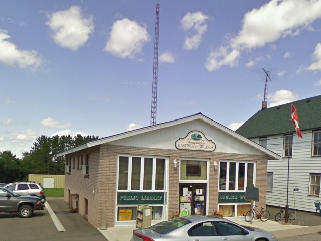
Photo from Google Street View ©2011 Google - Posted March, 2011
Plaque Location
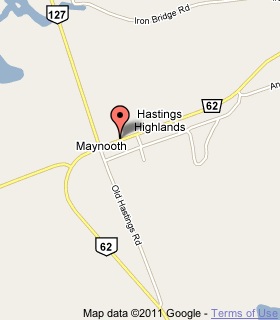
The County of Hastings
The Municipality of Hastings Highlands
In Maynooth, on the north side of Road 62
just east of Highway 127, street number 33011
Coordinates: N 45 13.886 W 77 56.211 |
 |
Plaque Text
The Peterson Road was named after Joseph S. Peterson, the surveyor who determined its route in this region. Constructed 1858-1863 at a cost of some $39,000 it stretched about 183 km between the Muskoka and Opeongo Roads and formed part of a system of government colonization routes built to open up the southern region of the Precambrian Shield. Poor soil disappointed hopes of a large-scale agricultural settlement along this road both on government "free-grant" lots and on the lands of the Canadian Land and Emigration Company. Though portions of the route were overgrown by the 1870's, the Maynooth-Combermere section aided lumbering and now contributes to the development of an important Ontario vacation area.
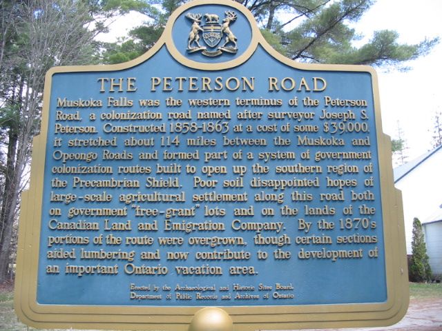
Photo by Alan L Brown - Posted May, 2005
Plaque Location
The District of Muskoka
The Town of Bracebridge
In Muskoka Falls, on the grounds of a church
on Morrow Drive near 4th Street
.7 km north of Highway 118
just east of its interchange with Highway 11
Coordinates: N 44 59.876 W 79 18.005 |
 |
Plaque Text
Muskoka Falls was the western terminus of the Peterson Road, a colonization road named after surveyor Joseph S. Peterson. Constructed 1858-1863 at a cost of some $39,000, it stretched about 183 km between the Muskoka and Opeongo Roads and formed part of a system of government colonization routes built to open up the southern region of the Precambrian Shield. Poor soil disappointed hopes of large-scale agricultural settlement along this road both on government "free-grant" lots and on the lands of the Canadian Land and Emigration Company. By the 1870's portions of the route were overgrown, though certain sections aided lumbering and now contribute to the development of an important Ontario vacation area.
Related Ontario plaques
Muskoka Road
The Opeongo Road
The Precambrian Shield
More
Information
More
Roads
Here are the visitors' comments for this page.
Posted November 19, 2011
Re: comment of Aug. 9: I empathize with anyone traveling and seeking plaques which are hard or impossible to find. It's especially aggravating when you might only be in an area rarely, if not once in a lifetime. Often have I looked in vain for plaques, but mostly before these websites came into being. What a great help they are. -Wayne
Posted November 6, 2011
The Peterson Road also continues past Maynooth and well into the Algonquin Park region. As it is true the the road was intended to open up the area for agriculture, it also lent a great aid for the lumber companys to get well into the interior and thus profit by the efforts of the generation before. Maynooth would not exist today if it wern't for the lumber industry at the time. As it's also true that the Peterson Road in used for vacationers, it's also a well known route for motor cyclists and people that own cottages along it's path.
DCS
Posted August 9, 2011
I was there Monday looking for the plaque. It's been displaced to accomodate some new centre the town has built. There's very nice landscaping outside the new building, and I hope they eventually get around to replanting the plaque. The highway sign is still there to tease you that there should be a historical marker. Very disappointing, because I don't get out that way very often.... it's rather far from anything.
Here's where you can write a comment for this page.
Note: If you wish to ask me a question, please use the email link in the menu.
Note: Comments are moderated. Yours will appear on this page within 24 hours
(usually much sooner).
Note: As soon as the comment is posted, a link to it will appear on the home page in the section "Here are the 10 latest plaque pages with a new comment added by a visitor to this site."
* Temporary Note: Due to my absence from my computer on August 24, 25 and 26, 2012, all comments sent on those days will not be posted until the 27th.