Ontario's Historical Plaques
at ontarioplaques.com
Learn a little Ontario history as told through its plaques
The Hastings Road
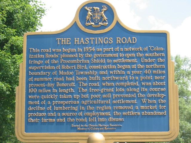
Photo by Alan L Brown - Posted July, 2005
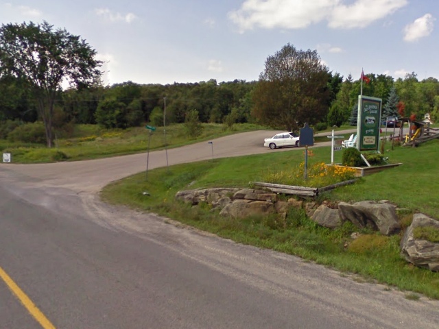
Photo from Google Street View ©2010 Google - Posted December, 2010
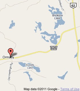
Plaque Location
The County of Hastings
The Township of Limerick
On the northeast corner of
Road 620 and Old Hastings Road
3.6 km west of Highway 62
Coordinates: N 44 52.882 W 77 45.014 |
 |
Plaque Text
This road was begun in 1854 as part of a network of "Colonization Roads" planned by the government to open the southern fringe of the Precambrian Shield to settlement. Under the supervision of Robert Bird, construction began at the northern boundary of Madoc Township and within a year 65 km of summer road had been build northward to a point near present-day Bancroft. The road, when completed, was about 160 km in length. The free-grant lots along its course were quickly taken up but poor soil prevented the development of a prosperous agriculture settlement. When the decline of lumbering in the region removed a market for produce and a source of employment, the settlers abandoned their farms and the road fell into disuse.
More
Information
More
Roads
Here are the visitors' comments for this page.
Posted June 14, 2008
Wonderful story. Thanks for providing it.
Here's where you can write a comment for this page.
Note: If you wish to ask me a question, please use the email link in the menu.
Note: Comments are moderated. Yours will appear on this page within 24 hours
(usually much sooner).
Note: As soon as the comment is posted, a link to it will appear on the home page in the section "Here are the 10 latest plaque pages with a new comment added by a visitor to this site."