Here's where you can learn a little Ontario history
The Founding of Blyth
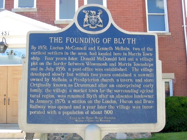
Photo by Alan L Brown - October, 2004
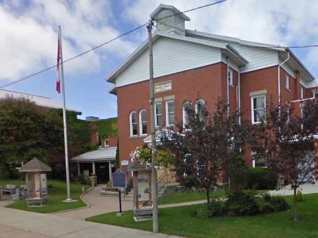
Photo from Google Street View ©2010 Google - December, 2010
Plaque Location
The County of Huron
The Township of North Huron
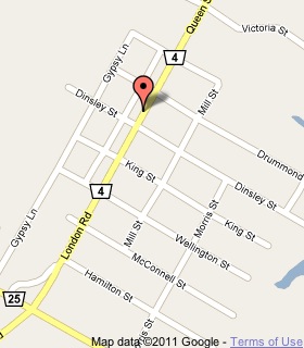
In Blyth, on the west side of Queen Street (Road 4)
between Dinsley and Drummond Streets
Coordinates: N 43 44.213 W 81 25.751 |
 |
Plaque Text
By 1851, Lucius McConnell and Kenneth McBain, two of the earliest settlers in the area, had located here in Morris Township. Four years later, Donald McDonald laid out a village plot on the border between Wawanosh and Morris Townships and in July, 1856, a post-office was established. The village developed slowly but within two years contained a sawmill owned by McBain, a Presbyterian church, a tavern, and store. Originally known as Drummond after an enterprising early family, the village, a market town for the surrounding agricultural region, was renamed Blyth after an absentee landowner. In January, 1876, a station on the London, Huron and Bruce Railway was opened and a year later the village was incorporated with a population of about 800.
More
Information
More
Settlements
Here are the comments for this page.
(none yet)
Here's where you can write a comment for this page.
Note: If you wish to ask me a question, please use the email link in the menu.
Note: Comments are moderated. Yours will appear on this page within 24 hours
(usually much sooner).