Here's where you can learn a little Ontario history
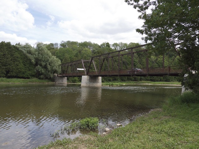
Ball's Bridge
Photos by contributor George Nassas - July, 2011
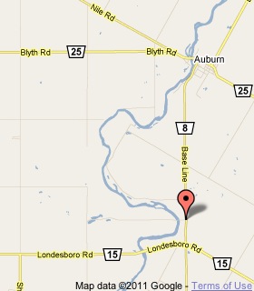
Plaque Location
The County of Huron
The Municipality of Central Huron
On Little Lakes Road, 20 m west of Road 8, 5 km south of Auburn
17.5 km northwest of Highway 8 in Goderich
via Highway 21 and Road 25
Coordinates: N 43 43.855 W 81 32.504 |
 |
Plaque Text
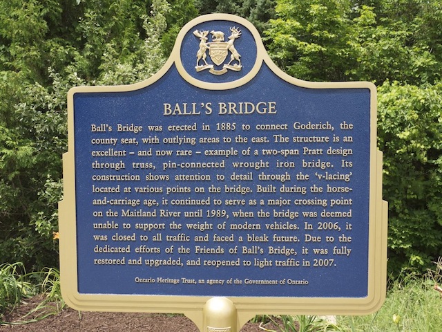
Ball's Bridge was erected in 1885 to connect Goderich, the county seat, with outlying areas to the east. The structure is an excellent - and now rare - example of a two-span Pratt design through truss, pin-connected wrought iron bridge. Its construction shows attention to detail through the 'v-lacing' located at various points on the bridge. Built during the horse-and-carriage age, it continued to serve as a major crossing point on the Maitland River until 1989, when the bridge was deemed unable to support the weight of modern vehicles. In 2006, it was closed to all traffic and faced a bleak future. Due to the dedicated efforts of the Friends of Ball's Bridge, it was fully restored and upgraded, and reopened to light traffic in 2007.
More
Information
More
Bridges
Here are the comments for this page.
(none yet)
Here's where you can write a comment for this page.
Note: If you wish to ask me a question, please use the email link in the menu.
Note: Comments are moderated. Yours will appear on this page within 24 hours
(usually much sooner).