at ontarioplaques.com
Learn a little Ontario history as told through its plaques
The Scugog Route
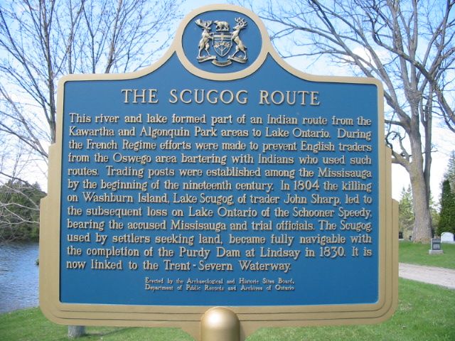
Photo by Alan L Brown - Posted December, 2010
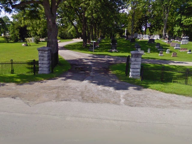
Photo from Google Street View ©2010 Google - Posted December, 2010
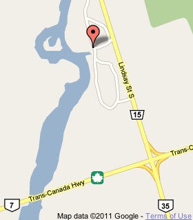
Plaque Location
The City of Kawartha Lakes
In Lindsay, in Riverside Cemetery on Lindsay Street South
not too far in from the centre entrance, 6.3 km north of Highway 7
Coordinates: N 44 20.060 W 78 43.605 |
 |
Plaque Text
This river and lake formed part of an Indian route from the Kawartha and Algonquin Park areas to Lake Ontario. During the French Regime efforts were made to prevent English traders from the Oswego area bartering with Indians who used such routes. Trading posts were established among the Missisauga by the beginning of the nineteenth century. In 1804 the killing on Washburn Island, Lake Scugog, of trader John Sharp, led to the subsequent loss on Lake Ontario of the Schooner Speedy, bearing the accused Missisauga and trial officials. The Scugog, used by settlers seeking land, became fully navigable with the completion of the Purdy Dam at Lindsay in 1830. It is now linked to the Trent-Severn Waterway.
Related Ontario plaques
The Loss of the "Speedy"
The Trent Canal
The Peterborough Lift Lock
Canal Lake Arch Bridge
More
Canoe Routes
Other Plaques in Lindsay
Purdy's Mills
Ernest Thompson Seton 1860-1946
Sir Sam Hughes 1853-1921
Here are the visitors' comments for this page.
(none yet)
Here's where you can write a comment for this page.
Note: If you wish to ask me a question, please use the email link in the menu.
Note: Comments are moderated. Yours will appear on this page within 24 hours
(usually much sooner).
Note: As soon as the comment is posted, a link to it will appear on the home page in the section "Here are the 10 latest plaque pages with a new comment added by a visitor to this site."