Ontario's Historical Plaques
at ontarioplaques.com
Learn a little Ontario history as told through its plaques
The Victoria Road
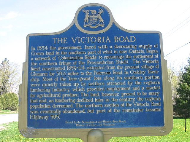
Photo by Alan L Brown - Posted December, 2010
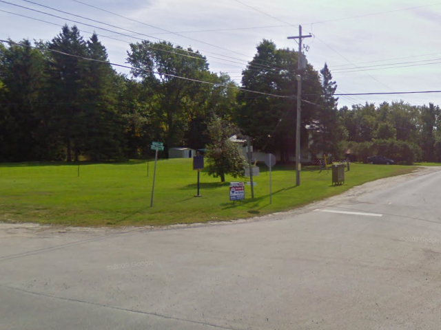
Photo from Google Street View ©2010 Google - Posted December, 2010
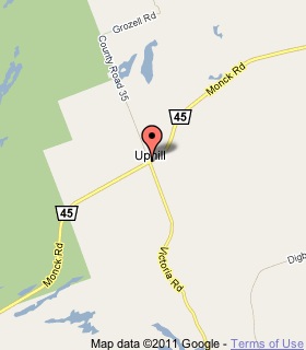
Plaque Location
The City of Kawartha Lakes
At the southeast corner of Road 35 and Road 45
Coordinates: N 44 44.451 W 79 00.530 |
 |
Plaque Text
In 1854 the government, faced with a decreasing supply of Crown land in the southern part of what is now Ontario began a network of "Colonization Roads" to encourage the settlement of the southern fringe of the Precambrian Shield. The Victoria Road, constructed 1859-64, extended from the present village of Glenarm for 62 km to the Peterson Road in Oakley Township. Most of the "free-grant" lots along its southern portion were quickly taken up by settlers attracted by the region's lumbering industry, which provided employment and a market for agricultural produce. The land, however, proved to be marginal and, as lumbering declined later in the century, the region's population decreased. The northern section of the Victoria Road was eventually abandoned, but part of the remainder became Highway 505.
More
Information
More
Roads
Here are the visitors' comments for this page.
(none yet)
Here's where you can write a comment for this page.
Note: If you wish to ask me a question, please use the email link in the menu.
Note: Comments are moderated. Yours will appear on this page within 24 hours
(usually much sooner).
Note: As soon as the comment is posted, a link to it will appear on the home page in the section "Here are the 10 latest plaque pages with a new comment added by a visitor to this site."