Ontario's Historical Plaques
at ontarioplaques.com
Learn a little Ontario history as told through its plaques
Ontario Boundary Dispute
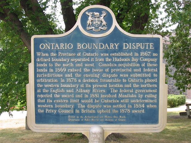
Photo by Alan L Brown - Posted July, 2006
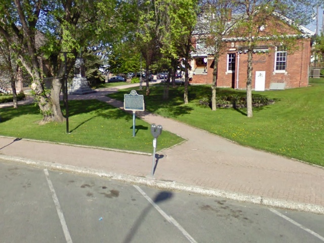
Photo from Google Street View ©2010 Google - Posted October, 2010
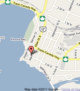
Plaque Location
The District of Kenora
The City of Kenora
On the west side of Main Street South
between 2 Street South and 3 Street South
Coordinates: N 49 45.940 W 94 29.494 |
 |
Plaque Text
When the Province of Ontario was established in 1867, no defined boundary separated it from the Hudson's Bay Company lands to the north and west. Canada's acquisition of these lands in 1869 raised the issue of provincial and federal jurisdictions and the ensuing dispute was submitted to arbitration. In 1878 a decision favourable to Ontario placed the western boundary at its present location and the northern at the English and Albany Rivers. The federal government rejected the award and in 1881 involved Manitoba by ruling that its eastern limit would be Ontario's still undetermined western boundary. The dispute was settled in 1884 when the Privy Council in Britain upheld the 1878 award.
More
Information
More
Boundaries
Here are the visitors' comments for this page.
Posted November 10, 2010
Using Lake Superior's drainage wouldn't expand Ontario, it would take a huge bite out of it. Lake of the Woods is in the Arctic Ocean drainage, not the Atlantic. It drains through the Winnipeg River to Lake Winnipeg, then through the Nelson River to Hudson Bay. But if the 1878 decision (by whom, I'd like to know) was upheld, why has only the western boundary been adhered to, and not the northern boundary in the Albany-English rivers area? Ontario's gone well beyond that. In any case, the court of final appeal should always have been our Supreme Court (established 1875), never something delegated overseas. As we saw with the Oregon Treaty, then the San Juan Islands settlement (1872), and would later see in the Alaska boundary resolution (1903), Canada could not trust Britain to act in its best interests. -Wayne
Posted November 4, 2010
Upper Canada, later Canada West, originally had the lands within the basin of all waters that flowed into Lake Superior; or something strangely worded like that designated to them. Lake of the Woods fits there in Ontario, even the drainage should make the border further west than it is... :) Sir John A was trying to curry favour with Manitoba by getting them annoyed at Ontario; and trying to stay in office. Fortunately heads were on right in Westminister. Besides everyone knows that three provinces should have been created in 1905, not just two.
Posted February 22, 2009
Pah. The Lake of the Woods should rightly have been awarded to Manitoba.
Here's where you can write a comment for this page.
Note: If you wish to ask me a question, please use the email link in the menu.
Note: Comments are moderated. Yours will appear on this page within 24 hours
(usually much sooner).