Here's where you can learn a little Ontario history
Umfreville's Exploration 1784
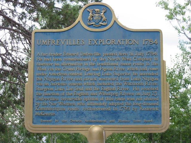
Photo by Alan L Brown - July, 2006
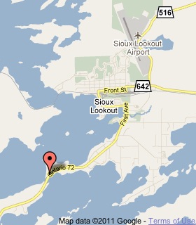
Plaque Location
The District of Kenora
The Municipality of Sioux Lookout
In a picnic area on the east side of Highway 72
about 5 km south of Sioux Lookout
Coordinates: N 50 04.283 W 91 56.774 |
 |
Plaque Text
A fur trader, Edward Umfreville, passed here in July, 1784. He had been commissioned by the North West Company to discover an alternative to the traditional canoe route to the West via the Grand Portage and Pigeon River, which had come under American control. Leaving Lake Superior, he ascended the Nipigon River and struck westward from Lake Nipigon via an intricate course which included the Wabinosh River, Sturgeon Lake, Lac Seul and the English River. He reached the junction of the English and Winnipeg Rivers on July 23. Umfreville's favourable opinion of this route was not shared by the Nor'Westers, who ultimately adopted the long-disused Kaministiquin route, rediscovered in 1798 by Roderick McKenzie.
More
Information
More
Events
Here are the comments for this page.
(none yet)
Here's where you can write a comment for this page.
Note: If you wish to ask me a question, please use the email link in the menu.
Note: Comments are moderated. Yours will appear on this page within 24 hours
(usually much sooner).