Ontario's Provincial Plaques
Here's where you can learn a little Ontario history.
The International Boundary
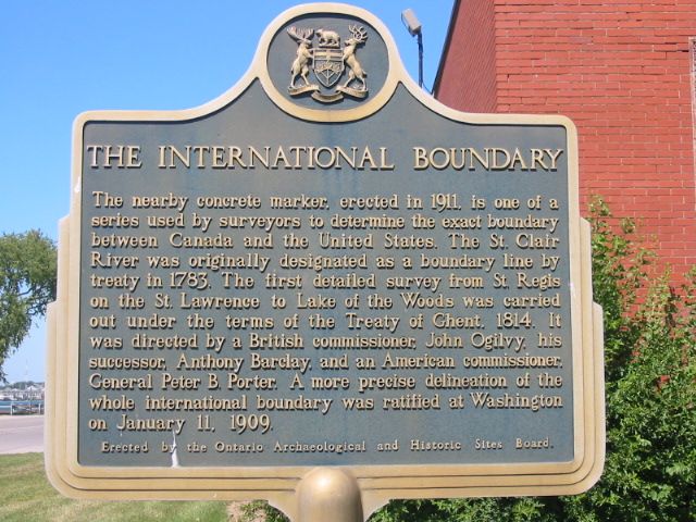
Photo by Alan L Brown - September 19, 2004
Photo by Alan L Brown - September 19, 2004
Plaque Location
The County of Lambton
The City of Sarnia
On the east side of the St. Clair Parkway, just north of a bridge over Talfourd Creek and south of La Salle Line (County Road 35)
Plaque Text
The nearby concrete marker, erected in 1911, is one of a series used by surveyors to determine the exact boundary between Canada and the United States. The St. Clair River was originally designated as a boundary line by treaty in 1783. The first detailed survey from St. Regis on the St. Lawrence to Lake of the Woods was carried out under the terms of the Treaty of Ghent, 1814. It was directed by a British Commissioner, John Ogilvy, his successor, Anthony Barclay, and an American commissioner, General Peter B. Porter. A more precise delineation of the whole international boundary was ratified at Washington on January 11, 1909.
Here's More
Information
Related pages:
Forty-Ninth Parallel
Niven's Meridian
Ontario Boundary Dispute
Here are the comments for this page.
(none yet)
Write a comment for this page.
(Note: If you wish to ask me a question, please use the email link in the menu.)
Note: Comments are moderated. Yours will appear on this page within 24 hours (usually much sooner).