at ontarioplaques.com
Learn a little Ontario history as told through its plaques
The St. Clair Tunnel
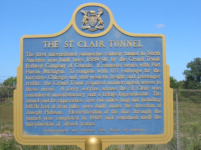
Photo by Alan L Brown - Posted September, 2004
Photo from Google Street View ©2010 Google - Posted December, 2010
Photo by Alan L Brown - Posted September, 2004
Plaque Location
The County of Lambton
The City of Sarnia
On the north side of St. Andrew Street
between Christina Street South and Vidal Street South
There is one other plaque at this location.
It can be seen on this page:
The St. Clair Tunnel
Coordinates: N 42 57.461 W 82 24.614 |
Plaque Text
The first international submarine railway tunnel in North America was built here, 1889-9, by the Grand Trunk Railway Company of Canada. It connects Sarnia with Port Huron, Michigan. To compete with U.S. railways for the lucrative Chicago and mid-western freight and passenger traffic, the Grand Trunk required uninterrupted access to these areas. A ferry service across the St. Clair was considered unsatisfactory and a bridge impracticable. The tunnel and its approaches, over 3 km long and including 1837 m of iron tube, were built under the direction of Joseph Hobson. Electrification of the line through the tunnel was completed in 1908 and remained until the introduction of diesel trains.
More
Information
More
Railways
More
Sarnia Plaques
Here are the visitors' comments for this page.
(none yet)
Here's where you can write a comment for this page.
Note: If you wish to ask me a question, please use the email link in the menu.
Note: Comments are moderated. Yours will appear on this page within 24 hours
(usually much sooner).
Note: As soon as the comment is posted, a link to it will appear on the home page in the section "Here are the 10 latest plaque pages with a new comment added by a visitor to this site."