Ontario's Historical Plaques
at ontarioplaques.com
Learn a little Ontario history as told through its plaques
The Founding of Arkona
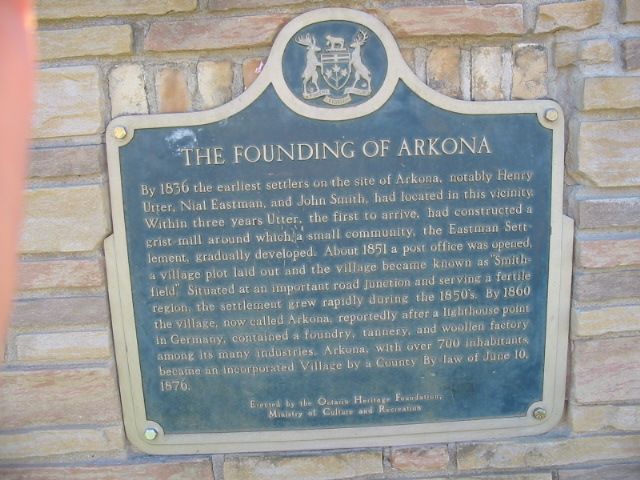
Photo by Alan L Brown - Posted September, 2004
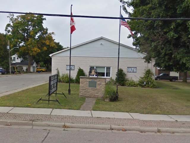
Photo from Google Street View ©2010 Google - Posted December, 2010
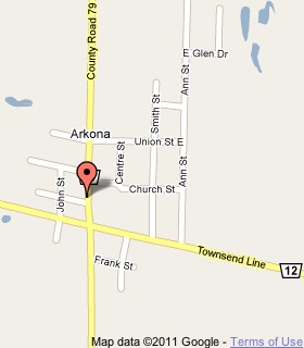
Plaque Location
The County of Lambton
The Municipality of Lambton Shores
In Arkona, on the northwest corner of
Arkona Road (Road 79) and Victoria Street
1 block north of Townsend Line (Road 12)
Coordinates: N 43 04.452 W 81 50.055 |
 |
Plaque Text
By 1836 the earliest settlers on the site of Arkona, notably Henry Utter, Nial Eastman, and John Smith, had located in the vicinity. Within three years Utter, the first to arrive, had constructed a grist-mill around which a small community, the Eastman Settlement, gradually developed. About 1851 a post office was opened, a village plot laid out and the village became known as "Smithfield". Situated at an important road junction and serving a fertile region, the settlement grew rapidly during the 1850's. By 1860 the village, now called Arkona, reportedly after a lighthouse point in Germany, contained a foundry, tannery, and woollen factory among its many industries. Arkona, with over 700 inhabitants, became an incorporated Village by a County By-law of June 10, 1876.
More
Information
More
Settlements
Here are the visitors' comments for this page.
(none yet)
Here's where you can write a comment for this page.
Note: If you wish to ask me a question, please use the email link in the menu.
Note: Comments are moderated. Yours will appear on this page within 24 hours
(usually much sooner).