Here's where you can learn a little Ontario history
Grand Bend
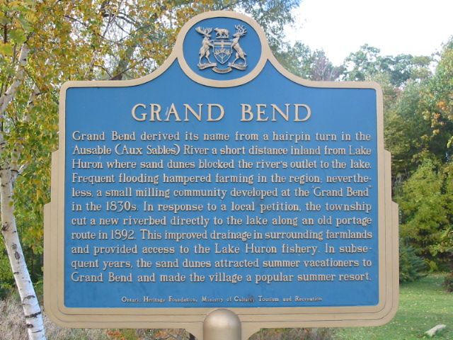
Photo by Alan L Brown - September, 2004
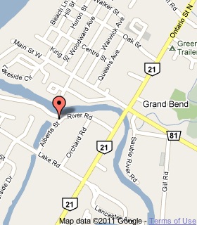
Plaque Location
The County of Lambton
The Municipality of Lambton Shores
In Grand Bend, at the intersection of River Road and Alberta Street
2 blocks west of Ontario Street South (Highway 21)
Coordinates: N 43 18.705 W 81 45.660 |
 |
Plaque Text
Grand Bend derived its name from a hairpin turn in the Ausable (Aux Sables) River a short distance inland from Lake Huron where sand dunes blocked the river's outlet to the lake. Frequent flooding hampered farming in the region; never-the-less, a small milling community developed at the "Grand Bend" in the 1830's. In response to a local petition, the township cut a new riverbed directly to the lake along an old portage route in 1892. This improved drainage in surrounding farmland and provided access to the Lake Huron fishery. In subsequent years, the sand dunes attracted summer vacationers to Grand Bend and made the village a popular summer resort.
More
Information
More
Settlements
Here are the comments for this page.
(none yet)
Here's where you can write a comment for this page.
Note: If you wish to ask me a question, please use the email link in the menu.
Note: Comments are moderated. Yours will appear on this page within 24 hours
(usually much sooner).