Ontario's Historical Plaques
at ontarioplaques.com
Learn a little Ontario history as told through its plaques
The Founding of Maitland
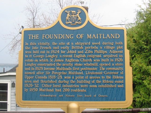
Photo by Alan L Brown - Posted June, 2004
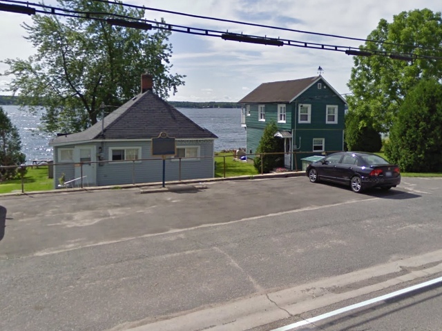
Photo from Google Street View ©2010 Google - Posted December, 2010
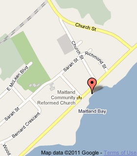
Plaque Location
The United Counties of Leeds & Grenville
The Township of Augusta
In Maitland, on the south side of King Street (Road 2)
between Church and George Streets
Coordinates: N 44 38.120 W 75 36.744 |
 |
Plaque Text
In this vicinity, the site of a shipyard used during both the late French and early British periods, a village plot was laid out in 1824 for Jehiel and Ziba Phillips. Adjacent to it George Longley, a recent English emigrant, acquired an estate on which St. James Anglican Church was built in 1826. Longley constructed the nearby stone windmill, opened a store and in 1828 became Maitland's first postmaster. The community, named after Sir Peregrine Maitland, Lieutenant-Governor of Upper Canada 1818-28, was a point of access to the Rideau area and flourished during the building of the Rideau Canal 1826-32. Other local industries were soon established and by 1850 Maitland had 200 residents.
Related Ontario plaque
Stamford Park
More
Information
More
Settlements
Here are the visitors' comments for this page.
Posted August 31, 2008
Today, August 31, 2008, my husband and I stopped at the George Longley mill tower in Maitland as we were visiting local lighthouses and thought it might be one only to find that we could not read the memorial that is there. It is in very bad condition and should be fixed for us history buffs who love finding these treasures.
Here's where you can write a comment for this page.
Note: If you wish to ask me a question, please use the email link in the menu.
Note: Comments are moderated. Yours will appear on this page within 24 hours
(usually much sooner).