Ontario's Historical Plaques
at ontarioplaques.com
Learn a little Ontario history as told through its plaques
Johnstown 1789
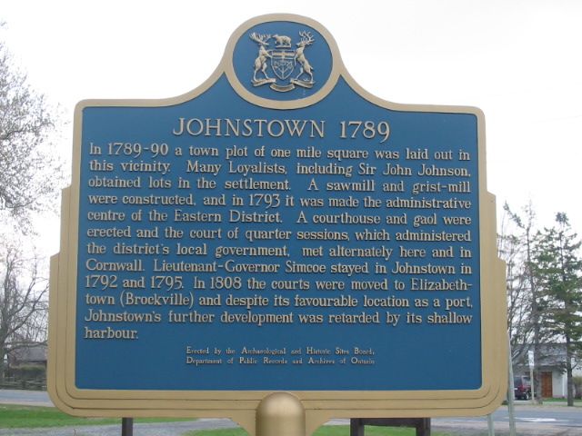
Photo by Alan L Brown - Posted June, 2004
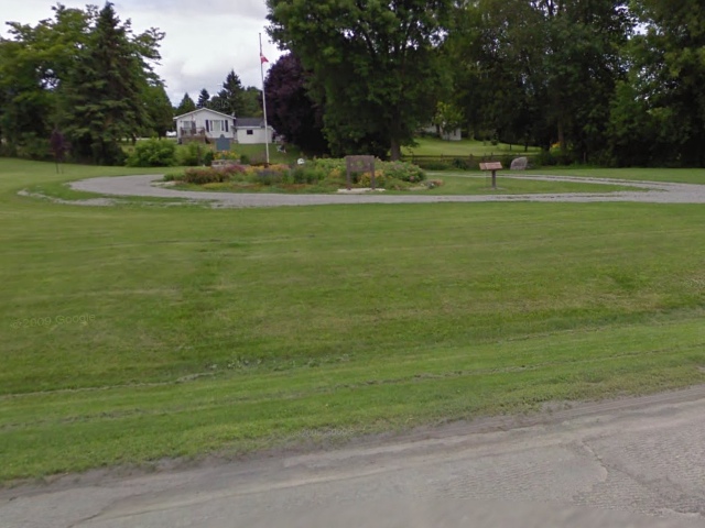
Photo from Google Street View ©2010 Google - Posted December, 2010
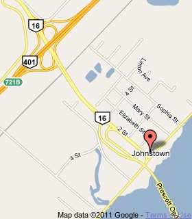
Plaque Location
The County of Leeds and Grenville
The Township of Edwardsburgh/Cardinal
In Johnstown, in a little park
on the northeast corner of Road 2 and Road 16
right near the Prescott Ogdenburg International Bridge
Coordinates: N 44 44.691 W 75 27.952 |
 |
Plaque Text
In 1789-90 a town plot of 1.6 km square was laid out in this vicinity. Many loyalists, including Sir John Johnson, obtained lots in this settlement. A sawmill and grist-mill were constructed, and in 1793 it was made the administrative centre of the Eastern District. A courthouse and gaol were erected and the court of quarter sessions, which administered the district's local government, met alternately here and in Cornwall. Lieutenant-Governor Simcoe stayed in Johnstown in 1792 and 1795. In 1808 the courts were moved to Elizabethtown (Brockville) and despite its favourable location as a port, Johnstown's further development was retarded by its shallow harbour.
Related Ontario plaque pages
Sir John Johnson's Mills
United Empire Loyalists
John Graves Simcoe 1752-1806
More
Settlements
Here are the visitors' comments for this page.
(none yet)
Here's where you can write a comment for this page.
Note: If you wish to ask me a question, please use the email link in the menu.
Note: Comments are moderated. Yours will appear on this page within 24 hours
(usually much sooner).