Ontario's Historical Plaques
at ontarioplaques.com
Learn a little Ontario history as told through its plaques
The Boundary Waters Treaty of 1909
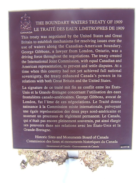
Photo by contributor Glen Curnoe - Posted March, 2010
Plaque Location
The County of Middlesex
The City of London
At the west end of Grosvenor Street in Gibbons Park
at the east end of the bridge over the river
Coordinates: N 42 59.919 W 81 15.836 |
Plaque Text
This treaty was negotiated by the United States and Great Britain to establish mechanisms for resolving issues over the use of water along the Canadian-American boundary. George Gibbons, a lawyer from London, Ontario, was a driving force throughout the negotiations. The treaty created the International Joint Commission, with equal Canadian and American representation, to prevent and settle disputes. At a time when the country had not yet achieved full national sovereignty, the treaty enhanced Canada's powers in its relations with both Great Britain and the United States.
More
Information
More
Boundaries
Here are the visitors' comments for this page.
(none yet)
Here's where you can write a comment for this page.
Note: If you wish to ask me a question, please use the email link in the menu.
Note: Comments are moderated. Yours will appear on this page within 24 hours
(usually much sooner).
Note: As soon as the comment is posted, a link to it will appear on the home page in the section "Here are the 10 latest plaque pages with a new comment added by a visitor to this site."