Here's where you can learn a little Ontario history
The Founding of Bracebridge
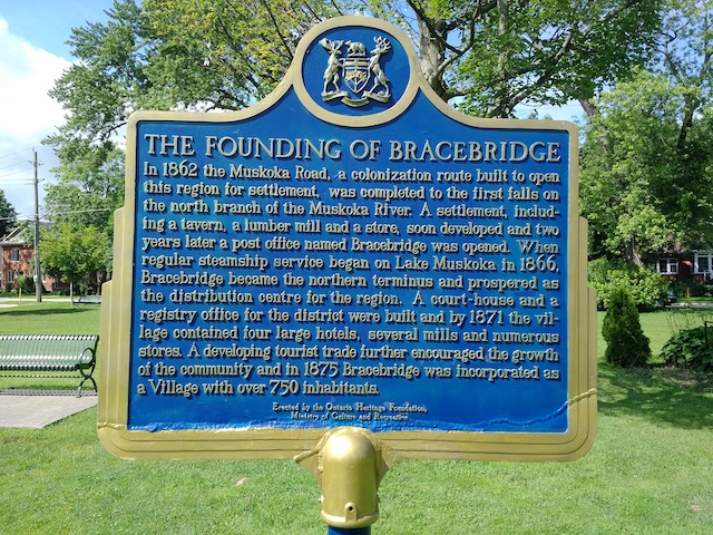
Photo by Alan L Brown - May, 2005
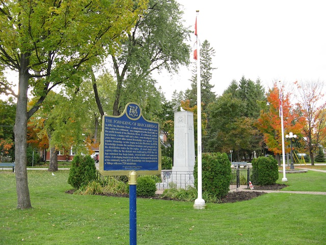
Photo by contributor Wayne Adam - December, 2009
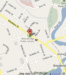
Plaque Location
The District of Muskoka
The Town of Bracebridge
In the centre of a park at the southeast corner of
Manitoba Street and Kimberley Street
Coordinates: N 45 02.549 W 79 18.813 |
 |
Plaque Text
In 1862 the Muskoka Road, a colonization route built to open this region for settlement, was completed to the first falls on the north branch of the Muskoka River. A settlement, including a tavern, a lumber mill and a store, soon developed and two years later a post office named Bracebridge was opened. When regular steamship service began on Lake Muskoka in 1866, Bracebridge became the northern terminus and prospered as the distribution centre for the region. A court-house and a registry office for the district were built and by 1871 the village contained four large hotels, several mills and numerous stores. A developing tourist trade further encouraged the growth of the community and in 1875 Bracebridge was incorporated as a Village with over 750 inhabitants.
Related Ontario plaque pages
Muskoka Road 1858
Steamboating in Muskoka 1866-1959
Muskoka District Court House 1900
More
Information
More
Settlements
Here are the comments for this page.
(none yet)
Here's where you can write a comment for this page.
Note: If you wish to ask me a question, please use the email link in the menu.
Note: Comments are moderated. Yours will appear on this page within 24 hours
(usually much sooner).