Here's where you can learn a little Ontario history
Founding of Baysville
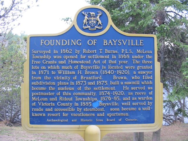
Photo by Alan L Brown - May, 2005
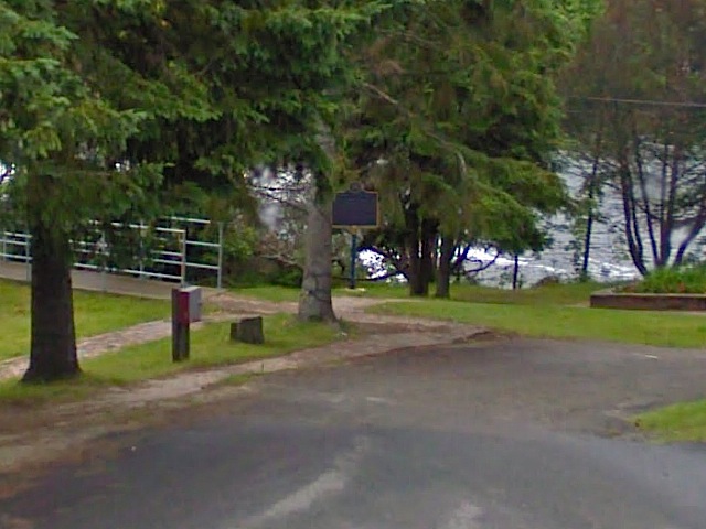
Photo from Google Street View ©2010 Google - December, 2010
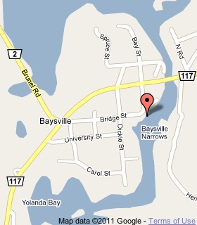
Plaque Location
The District of Muskoka
The Township of Lake of Bays
In Baysville, on Bay Street at Bridge Street
1 block south of Highway 117
Coordinates: N 45 08.916 W 79 06.796 |
 |
Plaque Text
Surveyed in 1862 by Robert T. Burns, P.L.S., McLean Township was opened for settlement in 1868 under the Free Grants and Homestead Act of that year. The three lots of which much of Baysville is located were granted in 1871 to William H. Brown (1840-1920), a sawyer from the vicinity of Brantford. Brown, who filed subdivision plans in 1873 and 1875, built a sawmill which became the nucleus of the settlement. He served as postmaster of this community, 1874-1920, as reeve of McLean and Ridout Townships, 1876-85, and as warden of Victoria County in 1885. Baysville, well served by roads and accessible by steamboat, soon became a well-known resort for vacationers and sportsmen.
Related Ontario plaque page
Steamboating in Muskoka 1866-1959
More
Information
More
Settlements
Here are the comments for this page.
(none yet)
Here's where you can write a comment for this page.
Note: If you wish to ask me a question, please use the email link in the menu.
Note: Comments are moderated. Yours will appear on this page within 24 hours
(usually much sooner).