Ontario's Historical Plaques
at ontarioplaques.com
Learn a little Ontario history as told through its plaques
Navy Island
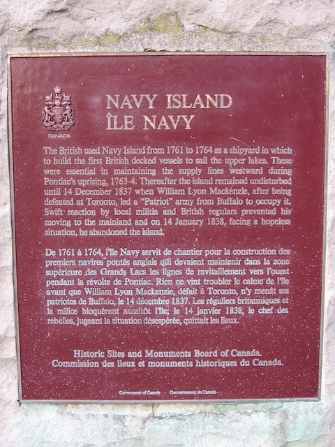
Photo by contributor Wayne Adam - Posted November, 2009
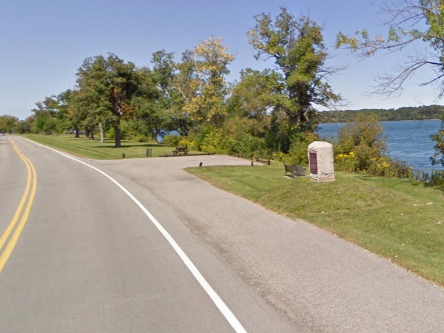
Photo from Google Street View ©2011 Google - Posted March, 2011
Plaque Location
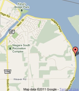
The Region of Niagara
The City of Niagara Falls
In a parking area on the east side of the Niagara Parkway
4.0 km south of the bridge over the Welland River in Chippawa
Coordinates: N 43 02.645 W 79 01.053 |
 |
Plaque Text
The British used Navy Island from 1761 to 1764 as a shipyard in which to build the first British decked vessels to sail the upper lakes. These were essential in maintaining the supply lines westward during Pontiac's uprising, 1763-4. Thereafter the island remained undisturbed until 14 December 1837 when William Lyon Mackenzie, after being defeated at Toronto, led a "Patriot" army from Buffalo to occupy it. Swift reaction by local militia and British regulars prevented his moving to the mainland and on 14 January 1838, facing a hopeless situation, he abandoned the island.
Related Ontario plaques
Mackenzie's Crossing 1837
The Destruction of the Caroline, 1837
Related Toronto plaque
William Lyon Mackenzie 1795-1861
More
Information
More
Assorted Places
Here are the visitors' comments for this page.
(none yet)
Here's where you can write a comment for this page.
Note: If you wish to ask me a question, please use the email link in the menu.
Note: Comments are moderated. Yours will appear on this page within 24 hours
(usually much sooner).
Note: As soon as the comment is posted, a link to it will appear on the home page in the section "Here are the 10 latest plaque pages with a new comment added by a visitor to this site."
* Temporary Note: Due to my absence from my computer on August 24, 25 and 26, 2012, all comments sent on those days will not be posted until the 27th.